Watch video
View slides
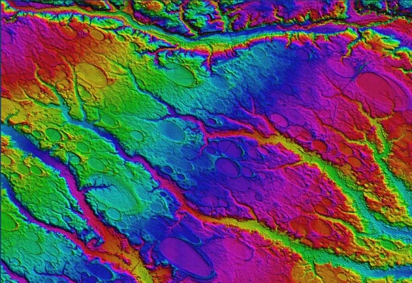
Light detection and ranging (LIDAR) technology is reshaping the civil engineering profession and offers many unique advantages. National efforts such as the 3D Elevation Plan (3DEP) are helping increase the availability of LIDAR data. LIDAR is one of the crucial technologies that is transitioning the world of civil and construction engineering from 2D paper-based design to 3D digital design. The high spatial resolution and accuracy capabilities of LIDAR have led to increased efficiencies, improved analyses, and more informed decision making.
A further advantage of this dataset is that multiple people can use the same dataset for a variety of purposes across multiple disciplines. The visual nature of the dataset also is more intuitive than traditional data acquisition and analysis techniques. This presentation will provide a brief background of LIDAR , its capabilities, limitations and platforms, and discuss its current and future role in civil engineering. Examples of a wide range of transportation, geotechnical, coastal, and structural engineering, science, and planning applications will be presented including development of mobile LIDAR guidelines for transportation applications, seacliff erosion in San Diego, CA, landslides and slope stability studies in Oregon, Alaska, and New Zealand, earthquake and tsunami damages in American Samoa, Chile, and Japan, cultural heritage in Florence, Italy, and in-situ change detection for geomorphological studies and infrastructure monitoring. Benefits and challenges of LIDAR for these applications will be highlighted. E-learning resources created as part of the mobile LIDAR guidelines for the website learnmobilelidar.com will also be shown.
Michael Olsen is an assistant professor of geomatics in the School of Civil and Construction Engineering at Oregon State University. He chairs the ASCE Geomatics Spatial Data Applications Committee and is an associate editor for the ASCE Journal of Surveying Engineering. He has B.S. and M.S. degrees in civil engineering from the University of Utah and a Ph.D. from the University of California, San Diego. He has also worked as an engineer in training for West Valley City. His current areas of research include terrestrial laser scanning, remote sensing, GIS, geotechnical engineering, earthquake engineering, hazard mitigation and 3D visualization. He teaches geomatics and geotechnical engineering courses at OSU where he has developed new, ground-breaking courses in 3D laser scanning and Digital Terrain Modeling. Recent projects he has been involved with include: development of mobile laser scanning guidelines for DOTs, earthquake reconnaissance (following the American Samoa, Chile, and Japan earthquakes and tsunamis), landslide and slope stability analysis, seacliff erosion mapping using LIDAR for San Diego County and Oregon, liquefaction hazard mapping for Utah, and modeling and studying historical buildings such as the Palazzo Medici and Palazzo Vecchio in Florence, Italy. Michael currently writes frequent articles for lidarnews.com.