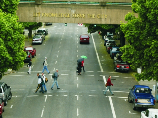
OTREC research from Portland State University has developed a new method of travel demand modeling for pedestrian trips.

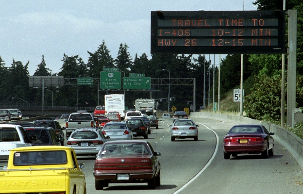
Transportation professionals use travel demand modeling to forecast how many people will be using a given portion of the transportation infrastructure. This is typically done using a four-step process, the first step of which relies upon a basic unit known as a transportation analysis zone, or TAZ.

A TAZ is a relatively coarse unit of space that can vary in size depending on planners’ needs; typically it encompasses somewhere around 3,000 residents.

Planners started using TAZs in the 1950s, on mainframe computers with limited capabilities, for guidance in making highway investment decisions. As transportation modeling practice has evolved, computers are capable of processing more data and models are being increasingly relied upon to answer more complex questions. 

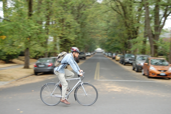
Despite growing investment in infrastructure that supports active forms of travel, existing modeling tools often poorly represent the nuances of the pedestrian environment. The project’s principal investigator, Kelly Clifton of Portland State University, explores ways to improve upon the modeling tools currently in existence.

... Read more

Portland State University engineering doctoral student Alex Bigazzi has developed a new course aimed at giving transportation engineers experience running emissions models. The course, Transportation Emissions Modeling, is offered through the Department of Civil and Environmental Engineering.

The practical nature of the course sets it apart from the few emissions courses offered at other universities, Bigazzi said. “Those tend to be on the policy side or the environmental side,” he said. “This is unique in trying to help engineers more than policymakers or future policymakers.”

The course fits with both Bigazzi’s own experience and Portland State’s faculty research strength in emissions and modeling. The university already offers an air quality course, but Bigazzi’s offering focuses narrowly on emissions from motor vehicles.

Students spent the first half of the inaugural course learning context for the models, including when they are used and what they can do. “There are federal requirements to do these models for all serious transportation projects,” Bigazzi said. “People need to understand what goes into them and how accurate they can be.”

Because emissions models aren’t as complex...

Read more

Portland State University inducted graduate student Kristina Currans into the Denice Dee Denton Women Engineers Hall of Fame in a ceremony Nov. 15. Currans is the second transportation engineering student to win the student award.

Maria Klawe, president of Harvey Mudd College, took the Outstanding Female Engineer honors.

Currans’ boundless enthusiasm and dedication to her work quickly become apparent to anyone who works with her, said Kelly Clifton, an associate professor of civil engineering and director of the Oregon Modeling Collaborative. “I’ve never met someone able to manage so many things,” said Clifton, who nominated Currans for the honor.

Currans works with Clifton as a part of the Oregon Modeling Collaborative and on several OTREC research projects. “She brings a tremendous amount of energy,” Clifton said.

After graduating Oregon State University with a civil engineering bachelor’s degree in 2010, Currans soon made a name for herself in transportation circles. She started her graduate coursework at Portland State and worked during academic breaks with the Oregon Department of Transportation’s Transportation Planning Analysis Unit, home to state and regional transportation models.

“For someone who had just graduated with an undergraduate degree, she completed that internship and really impressed ODOT,” Clifton said. “To do that so quickly caught everyone’s attention.”

Currans tested and worked with the Statewide Integrated...

Read more

When policymakers look to meet cycling goals by investing in new bicycle routes, they have little research to help them determine whether cyclists will actually use them. As a result, bicycle facilities aren’t considered equally with motor vehicle infrastructure.

That’s changing, thanks in part to OTREC research. An OTREC-funded study, the first to gather large-scale data that reveal cyclists’ actual route preference, is being published in a scientific journal (Transportation Research Part A). The findings have already been incorporated into the regional travel demand model used to make transportation investment decisions across the Portland region.

In the study, Portland State University researchers Joseph Broach, Jennifer Dill and John Gliebe (Gliebe is now with RSG Inc.) outfitted cyclists with GPS units to record which routes they chose and model the choices to reveal preferences. Previous studies have relied on stated preference surveys or less reliable methods of determining cyclists’ actual routes. The data gathering was supported by a grant from the Robert Wood Johnson Foundation through its national...

Read more

With transportation models increasingly used to inform policy decisions at all levels, OTREC is pleased to offer a free educational series designed to help decision makers, transportation officials and others understand these important tools. The series was organized with OTREC’s Oregon Modeling Collaborative and presented during the weekly transportation seminars at Portland State University’s Center for Transportation Studies.

Archived video of the entire eight-week series is now available. Each seminar lasts one hour. Click here for a description of each seminar and links to the video.

While the Friday seminar series has showcased transportation issues for years, the modeling series marks the first time that eight seminars focused on a single theme. Modeling is a timely topic, as policy makers come to rely increasingly on models, whether or not they have a background in modeling.

The series demonstrates how modeling can support better decision-making and explains the tools and the process to a nontechnical audience, said Kelly Clifton, director of the Oregon Modeling Collaborative. Oregon’s discussions regarding modeling tools have helped inform the national discussion, she said.

The final seminar in the series recapped some of the earlier lessons...

Read more

It’s not shocking that bridges built without thought to earthquakes wouldn’t make it through a big quake unharmed. More surprising, however, is how much damage even a relatively small earthquake would cause to Oregon’s bridges.

In an exhaustive OTREC project, researcher Peter Dusicka looked at the most common bridge types in the Oregon highway system. Those bridges weren’t just fragile, he found—they were even more fragile than other researchers and technical guidelines had suggested.

Dusicka published his preliminary findings in a draft report last year. The final report, “Bridge Damage Models for Seismic Risk Assessment of Oregon Highway Network,” is out now. Click here to download.

Most Oregon highway bridges were built before the 1980s, when designers started to consider seismic activity. Dusicka set out to see what would happen to the most common bridge type, continuous concrete multi-beam or girder, during quakes of varying degrees.

To find that out, he had to first know how the ground in the Pacific Northwest moves during and earthquake and second, model how the bridge type would react to these motions. Historical and geological evidence show a catastrophic earthquake will occur sooner or later in the region, Dusicka has said, as the Cascadia subduction zone stores up energy that will be released at some point. (...

Read more

Although specialized equipment and vehicles make up a large portion of state transportation budgets, an OTREC research report found little consistency in how states decide to replace this equipment.

Researchers David Kim and David Porter of Oregon State University surveyed 25 state departments of transportation to determine how they made replacement decisions. Nearly all consider the age of the vehicle or piece of equipment, with many considering how much use it gets.

Around half use thresholds, such as number of miles or months in service, to identify candidates for replacement. Some consider the equipment’s repair cost or operating cost, while others rely on physical inspections. None explicitly considers greenhouse gas emissions or other environmental concerns in its replacement criteria.

Given the huge range of approaches, Kim and Porter wondered if modeling could lead to better decision-making. They ran various models against the simple approach of using equipment age as a threshold value.

As it turns out, the simple approach isn’t too bad. In fact, it does better than one complicated mathematical model and about the same as a second model.

Click here to learn more about the project and ...

Read more

Transportation models keep growing more sophisticated. But complicated isn’t necessarily better, Rick Donnelly said during the inaugural seminar in OTREC’s spring 2012 transportation seminar series April 6.

“Better is contextual,” Donnelly said.

Donnelly, who leads the modeling and simulation practice at engineering consultancy Parsons Brinckerhoff, opened the spring seminar series with an introduction to models. Seven more free seminars follow in the series, produced in partnership with the Oregon Modeling Collaborative.

Donnelly detailed questions that model builders and users should ask and offered his thoughts on building more useful and informative models. Click here for a link to the archived presentation.

Although transportation models consider increasingly more information, simpler models can often get the job done with a smaller investment of time and money, Donnelly said. Sometimes the simplest approach actually produces the best results.

“’Better’ is only relevant in the context of what the model is going to be used for,” he said.

The modeling series continues Friday, April 13 with another seminar geared toward non-modelers. The seminar, by Ben Stabler, also of Parsons Brinckerhoff, builds on Donnelly’s opening installment.

Stabler will discuss two approaches to travel modeling and give...

Read more

Even as complex visual representations of data become common, many people still don’t understand what land-use and transportation modelers do. In April, state and local planning directors met to address that and other issues they’ll increasingly face in the coming years. The Oregon Modeling Collaborative convened the Oregon Transportation Policy Forum for guidance in developing the tools agencies will need and to keep agencies talking about transportation issues.

Giving a complex topic such as global warming the video game treatment could make it easier to grasp, said Angus Duncan of the Oregon Global Warming Commission. “I have yearned for something that’s the greenhouse gas equivalent of a ‘Sim City,’ “ Duncan said at the forum. “Something simple enough that kids can play with it, but something you can use for communication.”

Developers have gotten much better at representing data, said Tom Schwetz, director of development services for Lane Transit District, but leaps in handheld devices such as iPhones have raised expectations still higher. Transportation models are getting more complex and, at the same time, people are demanding their information quicker and quicker.

Modelers struggle, Schwetz said, both because people don’t understand the complexity of the models and because modelers themselves don’t explain themselves clearly. The models then become easier to attack than to defend. “There is a credibility issue,” he said. “It’s too easy to...

Read more

It’s a common occurrence: a digital signboard over the freeway tells you to expect a 15-minute trip, but traffic clears and you arrive in 10 minutes. Or, worse, you hit a clog and arrive in 30 minutes.

Sometimes those signboards, called dynamic message signs, are way off, Portland State University researcher Kristin Tufte found. But sometimes that doesn’t matter.

Tufte examined the signboards, called dynamic message signs, along Portland-area freeways in an OTREC project. Drivers typically reach their destinations earlier or later than the signs told them to expect when a so-called “shock wave” forms or dissipates; that is, when traffic suddenly bunches or clears up.

Currently, only three of the 30 or so message signs in the Portland metro area display travel times. Detectors at freeway onramps feed those signs. As a result, large swaths of freeway without onramps also have no data. To be most useful, new message signs would require more detectors in certain areas.

Take the busy Marquam Bridge in Portland, where busy freeways merge and there is no signboard. “There’s no detection for the whole length of the bridge,” Tufte said. “If you really want to have accurate travel times, you have to have detection there.”

As expected, Tufte found that traffic bunching or clearing in blind zones can throw off the accuracy of travel times displayed. Surprisingly, that inaccurate information is...

Read more

Pages