Impacts of NITC Research
With three successive US DOT university transportation center (UTC) grants, NITC maintained a focus on creating sustainable, livable, and equitable communities through the federal research priority of improving mobility of people and goods.
Below are a set of literature reviews and impact stories from more than a decade of NITC research covering some of the most important challenges facing transportation agencies and policymakers. Scroll down the page or click the links below to see NITC impacts in the areas of:
Transportation and Land Use
Travel behavior and land use are interconnected. In academic research, travel itself is often treated as a demand derived from the activities for which it serves. In practice, coordinating and linking transportation and land use decision-making proves to be challenging. Download the full literature review of NITC research in transportation and land use here, or you can download our two-page summary here.
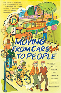
Moving From Cars To People: A Comic About Transportation and Land Use
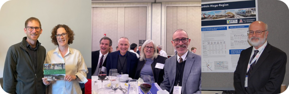
 NITC researchers have approached context-sensitive travel modeling from several angles. For example, Reid Ewing of the University of Utah developed some key enhancements to the classic four-step travel demand model, as well as examining trip and parking generation at transit-oriented developments. Kelly Clifton of the University of British Columbia (previously at Portland State) and Kristina Currans of the University of Arizona have a long history of collaboration around the data, methods, and processes used to plan for multimodal transportation impacts of new development.
But it's a complicated topic, and it can be difficult to communicate its importance.
That's why the NITC-funded transportation comic, "Moving From Cars To People," was created to provide a succinct and fun explanation of how the built environment in the United States came to be designed for cars and what we can do about it.
The twenty-page comic includes a dialogue, taking place in various urban settings, between characters Kelly and Kristi who are based on Currans and Clifton. This short graphic synopsis is an engaging, approachable way for anyone – no matter their level of expertise in this topic – to learn about their findings.
It's in everyone's interest for non-transportation-professionals to have a working knowledge of the conversation that's happening around sustainable transportation options. When important policy questions show up on a ballot – for example, whether businesses should be required to provide a certain amount of parking spaces, or whether the state should subsidize public transit – people who aren't in the transportation industry might not be fully aware of the tradeoffs involved in these questions. So having the whole subject distilled into an easy format can have important, positive outcomes in the long run.
Back to top
Economic Impacts of Transportation
NITC research examined the intersection of transportation and economics with several projects.
Transit Impacts on Jobs, People, and Real Estate
NITC researchers Chris Nelson. Robert Hibberd, Kristina Currans and Nicole Iroz-Elardo of the University of Arizona have conducted an extensive amount of research into transit and transit-oriented development impacts with the NITC project "Transit Impacts on Jobs, People, and Real Estate." The latest report, Transit Station Area Development and Demographic Outcomes, includes a foreword written by U.S. Congressman Earl Blumenauer. An excerpt reads:
"This report helps us think about how to build the types of communities that people want postpandemic. We must find ways to increase community connections, improve economic mobility, reduce greenhouse gas emissions, and ease people’s lives. The federal government has an important role to play in supporting the development of these communities and making sure they meet the needs of people across the country. Nelson and Hibberd lay out important considerations as we all undertake that work."
A recent related paper, "Complete Streets as a Redevelopment Strategy," was published in the U.S. Department of Housing and Urban Development's journal Cityscape: A Journal of Policy Development and Research. Read an August 2024 American Planning Association summary of that research by Nelson.
The research offers lessons for post-pandemic transit policy and planning. Notably, it calls for planners to downplay the role of offices in transit station areas and increase the opportunity for people to live in them. The report contains a wealth of data about transit's impacts on commuting mode choice, household demographics, real estate values, and more. It also outlines policy approaches to help mitigate adverse gentrification outcomes.
Using this research, transportation professionals can gauge the extent to which transit and land use planning and urban design interventions achieve desirable outcomes. Learning how to interpret the lessons of transit and real estate can help cities achieve their economic, equity, and sustainability-related goals.
Economic Impacts of Bicycle and Pedestrian Street Improvements
A frequent argument against bicycle and pedestrian infrastructure improvements is the concern that bike lanes could discourage customers and reduce revenues.
"Understanding Economic and Business Impacts of Street Improvements for Bicycle and Pedestrian Mobility," a NITC project led by Jenny Liu of Portland State University, provides a solid basis for policymakers, planners and other stakeholders considering street improvement infrastructure for pedestrian and bicycle mobility to make evidence-based investment decisions.
Overall, the study found very little evidence of active transportation street improvements having a negative impact on business or economic outcomes. In many cases, improved bicycle and pedestrian infrastructure was shown to have positive impacts on sales and employment in the retail and food service sectors.
Perhaps even more important than its findings, though, is the methodology developed in this study. Using a variety of data sources and analytical methods, this study provides policymakers and planners with a robust analytical framework and evidence to support nonmotorized transportation infrastructure investment. This study can serve as a model for other organizations wishing to conduct similar investigations.
Researchers analyzed street improvement corridors in six cities: Indianapolis, Memphis, Minneapolis, Portland, San Francisco and Seattle. Four types of economic data sources were collected for each city:
- Longitudinal Employer-Household Dynamics (LEHD) employment data,
- Quarterly Census of Employment and Wages (QCEW) employment and wages data,
- Retail sales tax data, and
- National Establishment Time Series (NETS) employment and sales data.
On this data, they applied three distinct analytical approaches:
- Aggregated trend analysis,
- Difference-in-difference (DID), and
- Interrupted time series (ITS) analysis
This multicity, multiapproach exploration allowed the authors to focus on a broader perspective than the individual findings in each corridor or city. They conducted detailed comparisons of the different available data sources and methodologies, elucidating the advantages, disadvantages and tradeoffs of each one.
The results are intended to encourage the application of similar corridor selection processes, data collection efforts and multimethod analyses in additional corridors and cities around the country.
Developing Tools for Social Workers, Engineers, and Planners to Address Mobility Gaps Collaboratively
An interdisciplinary approach developed by NITC researchers at the University of Texas at Arlington (UTA) has led to unique outcomes in the area of mobility justice and equity. By strengthening collaboration between the disciplines of planning, engineering, and social work, the researchers focused their efforts on building a transportation system that better serves everyone.
Transportation planners and engineers often struggle to serve at-risk communities and environmental justice (EJ) populations. EJ populations can include older adults, people with low income, low socioeconomic status, racial and ethnic minorities, and individuals with disabilities—all groups who are at an increased risk for transportation disadvantage. Evidence of these struggles manifest as unequal transportation system outcomes related to access and opportunity.
Meanwhile, social workers often struggle to connect with the planners and engineers whose transportation designs impact the individuals and communities that they work with.
UTA researchers Noelle Fields, Courtney Cronley, Kate Hyun and Stephen Mattingly collaborated on several projects using this unique approach.Fields and Cronley were both professors of Social Work at UTA, while Hyun and Mattingly are civil engineers. UTA's Sia Ardekani, and Arlie Adkins and Yi-Chang Chiu of the University of Arizona (UA) were also involved in several of the studies. The unique cross-discipline collaboration helped re-evaluate long-held assumptions and practices within the transportation and social work professions to better understand mobility gaps.
Each of the below projects used this interdisciplinary lens to approach equity challenges and improve access to travel for EJ populations:
- App-based Data Collection to Characterize Latent Transportation Demand within Marginalized and Underserved Populations
- To identify transportation disadvantages in their respective cities, professors from UTA, UA, and the University of Tennessee teamed up to design and test a travel diary app called MyAmble. Travel diaries are built for recording trips taken, but they often lack the ability to capture travel disadvantage or latent travel demand. In this context, travel disadvantage refers to essential trips that people plan to take but are unable to complete for some reason. Latent travel demand refers to trips that people would take but don’t bother to plan due to transportation barriers or safety concerns. The aim of MyAmble was to document trips taken as well as travel disadvantage and latent travel demand; reasons for the latter two; and real-time perceived impacts of transportation behaviors of the participants. The dataset created by MyAmble could help inform the designs of transportation systems that promote rather than restrict access to opportunities, creating a more equitable city that benefits all citizens.
- Access to Opportunities: Redefining Planning Methods and Measures for Disadvantaged Populations
- In this project, an interdisciplinary team of planning and public health researchers from the University of Arizona investigated how standard measures and conceptions of walkability hold up across socio-economic contexts. In parallel to this work, UTA engineering, public policy, and social work faculty worked with nonprofits and other service providers to characterize transportation gaps that result from system deficiencies at a regional scale. The end goal was to develop a roadmap for future research that could transform transportation planning practice to better account for disadvantaged communities.
- Evaluating Improved Transit Connections for Ladders of Opportunity
- Many transit operators employ limited strategies to provide connectivity to transit, like bicycle racks on buses. This project examined more innovative options, such as subsidies, hybrid ride sharing business models, flexible routing, smaller transit vehicles, transit-sponsored bike share programs, and social carpooling to meet first and last mile needs and increase mobility for all users, especially underserved and disadvantaged populations.
- How Can Interdisciplinary Teams Leverage Emerging Technologies to Respond to Transportation Infrastructure Needs? A Mixed-Methods Evaluation of Civil Engineers, Urban Planning, and Social Workers’ Perspectives
- The findings from this project indicated that there was a clear overlap in skills-based needs in connecting with stakeholders and public engagement for both social workers and transportation experts. With an eye towards training the next generation of professionals, the team established a background for developing an interdisciplinary course between the UTA College of Engineering and the UTA School of Social Work to address transportation equity and activity scheduling of EJ populations.
Back to top
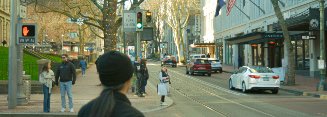
Walking and Bicycling
We have a long history in researching active transportation. Our studies have looked at bikeway infrastructure and signals to advance innovative design, and accessibility for bicyclists and pedestrians of all ages and abilities. We consider how cities and regions can better plan for and prioritize multi-modal transportation, particularly in historically underserved communities. NITC research has produced practical guidance for transportation professionals in cities across the country, and is being used to change national guidance such as the MUTCD and ITE Trip Generation manual. Download the full literature review of NITC research in walking and bicycling here, or you can download our two-page summary here.
The myriad benefits of active transportation, together with the many barriers that make it difficult for many people to travel by walking and bicycling, mean that research and practice must tackle challenges on multiple fronts. NITC research has provided engineering and design support, and offered guidance around budgeting, governance, equity practices, data management, policy and culture change. Such a multifaceted approach is necessary to build a healthy, sustainable transportation system, and NITC researchers over the past decade have made encouraging progress toward achieving this goal.
Healthy and Sustainable Transportation
Our research has shown that walking and bicycling are essential building blocks of healthy communities, with several studies noting the impact of active transportation on personal well-being. One study demonstrated that people with active commutes have lower levels of cortisol (a stress-induced hormone) throughout the day, and two other survey-based studies found that people who walk or bike to work report being happier and finding more value in their daily travel. These findings can greatly increase the explanatory power of mode choice models, and help support policies promoting nonmotorized travel.
NITC research has also demonstrated that good walking and biking options improve access to destinations and reduce the amount of money they spend on transportation. Several studies have shown that supportive walking environments improved mobility, through accessibility features such as curb ramps, for seniors and people with disabilities.
Improved walking and biking access also benefit communities on a larger scale. One NITC study found that active transportation street improvements led to either positive or non-significant economic outcomes, through increased consumer spending, for local businesses. Others have shown that walking and biking can reduce vehicle miles traveled and lower emissions, improving air quality and helping to mitigate the effects of the climate crisis.
Designing Infrastructure and Facilities
NITC research provides a good roadmap for the types of facilities that are most likely to improve safety and encourage walking and bicycling. Several NITC studies have reinforced the idea that infrastructure physically separating cyclists from people driving motor vehicles is the most comfortable for both cyclists and drivers. After separated bike lanes were installed in five U.S. cities, bicycle ridership increased: 10% of riders had switched to biking from other modes, and 24% had switched to the separated bike lanes from other bicycle routes. Over a quarter of riders indicated they were riding more because of the new lanes.
Another study evaluated cyclists' comfort levels in various intersection designs, finding that designs that minimized the interaction of people bicycling and cars – such as fully separated signal phases and protected intersections – were rated as most comfortable by a majority of users.
Emerging Technologies
New technologies such as e-bikes, e-scooters, and bike share are expanding the possibilities of bicycle transportation. NITC researchers have led the way in understanding how people are currently and could potentially use e-bikes. A 2017 study found that people who had borrowed an e-bike for ten weeks tended to bike more, and viewed themselves as more confident bikers, by the end of the study. A national survey of e-bike owners found that e-bikes expand both the number of people who can ride a bicycle, and also the number, types and lengths of trips that they are able to make. Bike share, too, makes bicycling possible for more people. NITC researchers have partnered with foundations and local partners around the country to seek to better understand the potential for bike share, through transportation cost savings and ease of access, to bring improved mobility and recreation opportunities to people in low-income communities.
NITC research is also helping cities and agencies prepare for new mobility services. A 2019 report analyzed potential impacts of new technologies such as e-scooter and bike share systems, ride hailing, and autonomous vehicles to help jurisdictions prepare. Another project collected and developed model policies and codes to guide communities navigate the changing landscape, and a third outlined potential applications for bicycles in a connected vehicle context.
Centering Equity
Walking and bicycling can be the cornerstone of equitable transportation, providing low-cost transportation, physical activity and contributing to healthy communities. However, research has demonstrated that, in practice, efforts to improve these modes have not always served underrepresented racial/ethnic and low-income communities.
NITC research has shown that different groups, including lower-income and minority populations, may interact with the built environment in different ways, such as walking more in environments typically viewed as less walkable, often out of necessity. A study based on interviews with women and minorities in Portland found that for these people, barriers to bicycling include the ordinary concerns about infrastructure, and additional concerns about being vulnerable to harassment and/or violence while riding. A study of bike share in disadvantaged communities found that lower-income and minority residents face greater and more barriers to using the bike share systems, ranging from affordability, comfort bicycling, through to knowledge about how to use the systems or what programming exists to help them access the system. To help bike share providers address these needs, NITC researchers produced a national scan of equity programs from 70 bike share operators to document best program practices and evaluations.
Black, Indigenous and other People of Color (BIPOC) are fatally injured at a higher rate while walking than white people. NITC research has identified several contributing factors to this disparity, including harsher pedestrian conditions in neighborhoods with higher BIPOC populations. A further potential contributor may be related to driver yielding behavior. A 2014 study and its 2017 followup found that Black male pedestrians were passed by twice as many drivers and waited 32% longer than white male pedestrians.
Back to top
New Mobility and Technology
Over the past 20 years, advances in technology have offered new opportunities for the mobility of people and goods. Transportation professionals have much to learn about the potential impacts of these emerging technologies on the creation of sustainable, livable, and equitable communities. Download the full literature review of NITC research in new mobility and technology here, or you can download our two-page summary here.
New Mobility: Impacts on Equitable Mobility
Advances in computer, cellular, and remote sensing technologies are expanding opportunities for the mobility of people and goods. The widespread adoption of smartphones has increased mobility options, as has the development of “new mobility” shared platforms including e-scooters, bikeshare, transportation network companies (TNCs), carshare, and microtransit. Given the relative nascency of these technologies, academics and the public and private sectors still have much to learn about the opportunities and challenges involved in their widespread adoption. But who is being left behind as technology advances?
Most of NITC's work around shared mobility programs focuses on equity, exploring how to increase participation and reduce barriers. A study on TNCs found that ride-hailing fills a transportation gap for nonprofits that provide services to communities, and recommends subsidies to support their use. Another study evaluated a program from the City of Portland in Oregon which provided transportation credits for residents of affordable housing, and found that many of the program's participants tried new modes they hadn't used before. They explored how e-scooters can be used in conjunction with other modes, such as bikeshare membership and transit, to improve access for residents on a low-income through the “Transportation Wallet” program. Other research examined the equity requirements of over 230 shared mobility programs and bike share programs across the U.S. and evaluated how effective these programs are at increasing adoption among target populations.
New Mobility: Impacts on Health and Safety
Safety is a major concern when examining e-scooter adoption in cities. NITC researchers have examined the safety of e-scooters and of interactions with other modes, as well as user demographic and location considerations. NITC funds have also been used to study e-scooter parking and the safety issues related to e-scooters that potentially block sidewalks and curb cuts.
New Mobility: Implications for Public Policy
There is a body of research funded by NITC that explores models of governance and policy approaches for the deployment of new mobility pilot projects, including micromobility and autonomous vehicles (AVs). In addition to providing model language for regulations, NITC researchers are considering the fiscal implications of some of these services. One study examined how the adoption of AVs is changing both mobility and e-commerce deliveries, and how cities can adopt a new mobility strategy in response to these changes. Another explored the potential fiscal impacts of AVs on cities through the proxy study of TNCs, and suggested regulatory changes to mitigate these impacts. A third assessed over 220 new mobility and urban delivery pilot projects in the US and Canada, and conducted 11 case studies to catalog lessons learned, emerging trends and considerations and promising practices.
A review of e-scooter adoption in Portland, OR examined the change in vehicle miles traveled (VMT) since adoption. Researchers analyzed the charging operations of e-scooter companies in the metro region and the mode shift of individuals using e-scooters. Results from this study estimate the impacts of different company operations and best practices in increasing safety, addressing equity, and reducing air pollution.
Transportation Technology: Implications for Transportation System Management
New technologies are improving the design and operations of intelligent transportation systems (ITS) through improved signals, sensors, travel time predictions, and connected vehicles (CVs). Some NITC work has involved the creation or improvement of ITS technology, while others have explored the implications of its use.
Researchers are exploring highway performance with connected autonomous vehicles (CAVs) and their interaction with human-driven vehicles. One study used data-driven optimization models and efficient computation methods to help solve e-scooter distribution and operation problems.
Other NITC work focuses on the changing travel behaviors associated with online shopping, such as examining how the COVID-19 pandemic has changed shopping habits among American consumers. Other studies examine the environmental impacts of e-commerce, including travel-related emissions and the recycling of shipping packaging and materials, which may strain recycling systems and waste collection.
Transportation Technology: Prioritizing Active Transportation
Smart city research focuses on making the transportation system more efficient and increasing traffic flow and safety. Research encompasses multiple modes, including transit, bikes, and automobiles. One study focused on improving flow for bicyclists on a bike corridor with fixed-time signals using a cellphone-based app. NITC-supported smart city research focuses on some of the most vulnerable road users, such as those who depend on curb ramps, as well as how to improve the transportation system for pedestrians, bicyclists, and transit riders. GeoAI methods such as open street map, LiDAR, and aerial imagery can be used to fill in missing curb ramp data to help those with limited mobility navigate around urban spaces.
Research Into The Potential of E-Bikes
Under the leadership of TREC's sustainable transportation program manager, John MacArthur, NITC has developed a wealth of research around electric bicycles (e-bikes) to understand the potential for e-bikes to meet people's mobility needs, increase access to active transportation options, and address sustainability goals. Findings from this research have been used in policy discussions at the local, regional, state and federal level.
"Estimating the Effect of E-Bikes on Person Miles Travelled and Greenhouse Gas Emissions," a white paper, found that given a 15% e-bike mode share in Portland, Oregon, the city's CO2 emissions would be reduced by over 900 metric tons per day. The researchers conclude that the strategy of increasing e-bike mode share can be used confidently as a tool to help meet carbon emission reduction goals.
A second white paper, "Using E-Bike Incentive Programs to Expand the Market," recorded trends and best practices for using e-bike incentive programs to expand the market. The researchers then developed an e-bike incentive tracker which offers an overview of the existing incentive programs in the United States and Canada, a resource for governments and clean energy advocates looking to encourage people to use e-bikes for transportation.
The researchers have conducted multiple surveys of e-bike riders for insights into where, when, and why they ride, with implications for planning and policy as well as strategies for increasing the mode share.
The team also created an online tool that enables policymakers, public stakeholders, and advocates to quickly visualize the potential outcomes of an electric vehicle incentive program made up of several vehicle types. The tool estimates the cost efficiency of a proposed program in terms of the cost per kg CO2 avoided by each mode over the course of one year. It also takes the proposed budget into consideration to calculate the potential number of incentives to be made available and the amount of total CO2 that would be avoided due to internal combustion engine automobile VMT displacement.
Back to top
Transportation Equity
Given the historical inequalities that low-income communities and communities of color have faced in the U.S., transportation equity envisions a future where all individuals, regardless of their life circumstances, have the mobility options needed to thrive. Download the full literature review of NITC research in transportation equity here, or you can download our two-page summary here.
Overall, NITC research demonstrates that increasing the representation of communities of color, underserved populations, and women in city and transportation decision-making can effect the greatest positive outcomes for those communities.
Equity in Infrastructure
Many infrastructure-focused NITC reports offer a cost-benefit analysis of updating infrastructure to address transportation inequities. For example, approximately 30% of transit riders rely heavily on cash, and an examination of automated payment systems for public transit found it increased access and was operationally cost-effective to retain cash payment options on buses.
Another dimension of infrastructure explored is transportation planning for optimizing accessibility to areas outside of large urban cities. One study examined the impact of transportation infrastructure and economic growth in Collin County, Texas on quality of life outcomes for residents. Although employment opportunities were increasing in the fast-growing Dallas suburb, poor and outdated transportation infrastructure prevented residents from accessing the full benefits of the economic "boom." For similar issues in rural regions, NITC work has empowered a network of planners in western gateway and natural amenity region (GNAR) communities. Rapid growth in tourism has caused unique transportation challenges for rural residents and access to amenities.
Finally, two NITC projects addressed transportation equity at bus stops. One study found that improved bus stop features (e.g. shelters, curb cutouts, access ramps, and benches) increased ridership and reduced demand for ADA paratransit. The authors conclude that physical features of bus stops are fundamental to equitable access, particularly for riders with mobility-based disabilities, and should not be treated as "amenities." Another ranked the "livability" of bus stops in Eugene, Oregon to explore what factors impacted people's choice to use public transportation, most notably a location in a quiet area, access to pedestrian paths that connect to other areas in the city, safety, and protection from adverse weather.
Accessibility
Other studies of transit fare equity found that fares based on distance traveled would benefit low-income individuals, older populations, and communities of color. However, this outcome was found to be geographically uneven, so that distance-based fare structures might have a negative impact if they live on the outskirts of urban areas. Planners and policy-makers need to eliminate common barriers to equitable public transit access, including improving both tactile and verbal information at stops and onboard, adding sidewalks and crosswalks to areas surrounding stops, and promptly removing snow on sidewalks and in crosswalks around stops.
Technology-based concerns have been explored in several studies, including transportation limitations for older adults which found that while the COVID-19 pandemic improved technology use for many older adults, barriers still exist for low-income older adults who are less likely to use the Internet or technology to access transportation resources. Policy strategies could support older adults’ transportation independence through education, and increased access to affordable door-to-door transportation options such as ride-hailing services and vanpooling. Another project examined the use of ridehail services linking clients to nonprofit services and found that some clients did not have access to a smartphone or credit card, both of which are necessary for using ridehail services.
There are also accessibility concerns around cycling in urban areas and using bikeshare programs. One NITC project found that women and cyclists of color face challenges like personal safety concerns, gendered harassment, parenting, racial profiling, lack of women and minorities in both cycling culture and in city and transportation planning meetings. Updated infrastructure such as protected bike lanes, bikeshare stations, and street lighting could help mitigate some of these concerns. Another study examined equitable access to bikeshare programs across the U.S. and reported several barriers for low-income and minority populations, including programmatic costs, technology-dependent payment systems, and poor or nonexistent investment in infrastructure in those neighborhoods. Increased education and outreach in multiple languages, standardized rental structures, and low-income fare programs could overcome some of these barriers.
Safety
NITC research has a strong focus on safety, including physical safety while biking, walking, and riding transit and those concerns further exacerbated by racism and gendered/sexual harassment. One study on collision and non-collision incidents involving buses found that the majority of incidents occurred at “stop segments” of bus routes: stop signs, intersections, and bus stops. Both types of incidents were higher at route turns, and the most severe (e.g., a bus hitting a pedestrian) occurred most frequently at intersections. Researchers recommend updating infrastructure to improve safety, including additional street lighting and lighting at transit stops, new or repaired sidewalks and crosswalks, and barriers near bus stops to maintain space between pedestrians and moving buses. They also recommend improved pedestrian warning technologies at crosswalks and bus stops to alert pedestrians of buses turning, pulling in or out, or deploying ramps.
Another study explored the effect of drivers’ attitudes toward bicyclists on their self-reported safety behaviors, and found that survey respondents with a pro-driver implicit bias were associated with anti-bicyclist explicit attitudes. Recommendations to improve bicyclist safety include increasing the number of designated/protected bike lanes and clarifying passing laws for drivers passing cyclists.
Historical Inequities
Our transportation research has studied gentrification, neighborhood development and change, and impacts on historically underrepresented communities, including Black, Indigenous, and people of color (BIPOC) communities, immigrants, and people with disabilities. In a report on gentrification and neighborhood displacement that compared case studies in two low-income Latino neighborhoods (Fruitvale Transit Village in Oakland, CA and MacArthur Park METRO Transit-Oriented Development in Los Angeles, CA), researchers found that transit-oriented development projects have the ability to lead neighborhood revitalization projects. When planned with equitable outcomes in mind, these investments have the potential to increase access to regional transportation systems and affordable housing and social services, as well as support local Latino-owned businesses. Project developers should take guidance from community members so that transit projects build upon neighborhood assets and existing capital.
Back to top
Infrastructure and Transportation System Resiliency
Recent decades have seen an increase in catastrophic environmental events that trigger concern for resiliency in our communities, the built environment, and transportation systems. Transportation professionals need to understand how to prepare, respond and recover from these events, and adapt to mitigate the impacts. Download the full literature review of NITC research in transportation resiliency here, or you can download our two-page summary here.
The recently passed Infrastructure Investment and Jobs Act (2022) and the Justice40 Initiative present significant opportunities to improve resilience in our transportation systems, and consequently in our communities. What is needed now is actionable research that allows transportation planners and policymakers to make sound, evidence-based decisions on resiliency both quickly and confidently. NITC research has made contributions to this goal by engaging multiple disciplines, bringing together diverse communities of practice, and bridging the research-practice divide. Researchers at the six NITC partner universities have undertaken numerous studies funded by other organizations in the area of transportation resiliency, and are poised to apply that expertise to future NITC-funded research.
Disaster Phases: Preparation, Recovery, and Long-Term Resiliency
Our studies focus on the preparedness and response phases of a disaster, as well as recovery, mitigation, and adaptation. The studies in preparedness and response focus on engineering assessments for rapid response or mobility and access in the post-disaster moment. Studies on mitigation, recovery and adaptation covered a broad range of topics: from seismic retrofitting of transportation infrastructure to climate action planning in transportation agencies. Case studies on long-term post-disaster recovery are an opportunity for future NITC work to increase resiliency in transportation systems.
Transportation Infrastructure
About a third of NITC's work in resiliency has focused on the engineering and maintenance of transportation infrastructure in the face of environmental change. One study prioritized the retrofitting of highway bridges in Oregon based on their seismic vulnerability, determining which needed to be retrofitted soonest. NITC funding has also supported diversifying the workforce by funding university student researchers and providing the unique opportunity to learn technical skills that are desperately needed by local consultants in the Pacific Northwest, such as assessing the liquefaction potential of regional soils and effects on bridge foundations.
Planning Support Tools
NITC research produces decision-making tools to support evidence-based transportation resilience engineering, planning and policymaking. Several studies have assessed the performance of structures (such as bridges, culverts and highways) during hazard events like earthquakes, flooding, and wildfires. Others have focused on different aspects of the transportation system, such as governance needs and supply chain management. One team of NITC researchers published Rethinking Streets During COVID-19, a book in a series of three on repurposing street space to better meet community needs. This edition compiles examples of street improvements from cities across the U.S., to help planners and engineers, local elected officials, and other city staff visualize how other communities responded to travel changes brought about by the COVID-19 pandemic and related lockdowns.
Mobility and Accessibility
In the aftermath of hazard events, improving mobility and access to services is one of the first priorities to help a community recover. NITC research has improved our understanding of how communities respond to hazards; not only physical disasters like earthquakes, fires and floods, but also public health events like the COVID-19 pandemic. One study examined how households acquired food and other necessities during the first two years of the pandemic, and identified the most common barriers faced by vulnerable subgroups, which include lack of access to a credit or debit card, smartphones, internet, a secure place to receive deliveries, and to a vehicle.
The climate crisis is another focus of transportation resiliency research, and NITC researchers have begun to examine how infrastructure can impact public health as global temperatures rise. With road pavement being a known contributor to the urban "heat island" effect, one NITC study evaluated a pilot program in Tucson, Arizona where the city applied engineered pavement coatings to reflect light and reduce the thermal load of roads. The same study also investigated the public health consequences of drive-through COVID-19 vaccination sites, where people spent many hours waiting in line in a high heat-risk environment with idling vehicles.
Governance and Policy
The NITC community has used survey and qualitative approaches to enhance our understanding of governance and policymaking in transportation resiliency. One study worked with local agencies in Salt Lake City to develop a collaborative university/community framework that can help small and medium-sized enterprises recover from supply chain disruptions after an earthquake. They surveyed 130 local businesses within the top 10 worst-affected industrial sectors in Utah to understand how they navigated supply chain disruptions. They investigated how universities and local governments could support their efforts, in order to promote collaborative resilience planning. The exchange of ideas between policymakers and administrators in other regions promotes cross-learning, which helps to establish policies for resilient transportation systems.
Equity and Justice
Environmental change events can have a heavily disproportionate impact on low income, socially vulnerable, and otherwise marginalized community groups. While many resiliency studies mention or address equity in some measure, fewer have equity as their primary focus. One study conducted a flood vulnerability assessment with special reference to low-income and minority neighborhoods in Tucson, Arizona. The research team identified priority locations for Tucson to make transportation improvement investments for the purpose of mitigating urban transportation system flooding where it is needed most. They found that building comprehensive neighborhood-scale green infrastructure in the right-of-way is effective at increasing multimodal access in moderate flooding conditions. Another project developed a new accessibility measure to support older adults in the post-pandemic world, identifying and quantifying the unique challenges faced by older people to help decision makers integrate equity into future policy frameworks.
It’s important to note that this literature review reveals a lack of research emphasis on the intersection of equity and transportation resiliency across all university transportation centers (UTCs). This is a major blind spot and needs to be critically addressed in future research.
Back to top
Sustainable Transportation Systems
Below are some highlights from NITC research into improving the sustainability of transportation systems.
Applying a Mt. Mazama Volcanic Ash Treatment as a Trail Accessibility Improvement
In a stellar example of moving research into practice, researchers at Oregon Tech paved a pilot section of trail using a NITC-developed sustainable paving method. A quarter-mile section of the Klamath Geo Trail, just east and up the hill from the Oregon Tech Klamath Falls campus, was successfully resurfaced using volcanic ash from Mount Mazama.
Substituted for portland cement, Mazama ash can be used as a more sustainable, locally sourced pozzolan to firm up gravel roadways and trail surfaces. Building on previous work by Matthew Sleep and Damien Matzen of Oregon Tech, researchers C.J. Riley and Ashton Greer employed a Mt. Mazama volcanic ash soil amendment to improve the surface stability and firmness of the trail.
The research team conducted before-and-after tests using wheelchairs and other wheeled devices, to evaluate the firmness of the trail surface. After the treatments, the surface was significantly more firm and stable, meaning that people who use mobility devices could now enjoy improved access to the natural area.
Most pavement projects use portland cement, which takes an excessive amount of energy to create: mining minerals, transporting them, and super-heating them. Such complex chemical reactions, similar to those needed to artificially create portland cement, took place naturally when the volcano erupted. Today, orange-colored deposits of Mazama ash are plentiful throughout southern Oregon and much of the Pacific Northwest, and are already being mined for other purposes. The work done by the Oregon Tech team paves the way (no pun intended) for further development of their process and technique, which could eventually lead to natural pozzolans like Mazama ash being used more widely throughout the industry.
Deployment of Electric Buses Considering Cost and Environmental Equity
Encouraged by the urgent need for cleaner alternatives to fossil fuels, vehicle electrification has been advancing at an unprecedented pace. The transit industry is rapidly transitioning to battery-electric fleets because of the direct environmental and financial benefits they can offer. They are quieter, have lower maintenance costs, and produce significantly lower greenhouse gas emissions than diesel, diesel hybrid and natural gas-powered buses, which is good news for tackling our climate crisis.
Cathy Liu of the University of Utah, with PSU's Aaron Golub and Ran Wei of UC Riverside, created a web-based modeling tool that enables U.S. transit providers to explore the impacts of changing over their systems to battery electric buses, or BEBs. The researchers ran the model for TriMet in Portland, OR, as well.
The project doesn’t focus solely on climate goals and lowering costs for transit agencies: The modeling tool also allows agencies to prioritize environmental equity.
People with lower incomes tend to suffer more from health conditions caused by air pollution. It’s a result of historically inequitable planning processes, with lower-income neighborhoods often placed close to industrial land uses and freeways with high emissions. As a way of addressing this problem in tandem with environmental goals, researchers developed the tool to help transit agencies replace their current fleets with electric buses that is both cost-effective and prioritizes deployment near low-income populations that suffer most from unhealthy air quality.
This research set the foundation for transit agencies to develop optimal deployment strategies for BEB systems when multiple goals need to be considered, allowing planners and decision-makers to create a transportation ecosystem that better serves livable and sustainable communities.
"Bi-Objective Optimization for Battery Electric Bus Deployment Considering Cost and Environmental Equity," a paper published in Transactions on Intelligent Transportation Systems, the Institute of Electrical and Electronics Engineers (IEEE) Journal, highlights several subsequent requests to the Federal Transit Administration (FTA)'s low or no-emission grant that have been built upon that NITC research effort.
Back to top
Safer Streets for Active Transportation
Another focus of NITC research was active transportation safety, including the projects featured below.
Lessons from the Green Lanes
Protected bike lanes, sometimes called cycle tracks, are on-street lanes separated from traffic by curbs, planters, parked cars or posts to help organize the street and make riding a bike appealing for people of all ages and abilities. NITC research led by Christopher Monsere, Jennifer Dill, Kelly Clifton and Nathan McNeil of Portland State University evaluated the risks and rewards of cities' investment in putting these facilities on the ground.
The researchers found that bicycle ridership increased on all the studied streets, with an average increase of 72 percent. Some people said they cycled more in general because of the new lanes. Some said they would have taken another mode of transportation, such as driving or transit, or used another route if the protected lane hadn’t been there.
"For some people, it’s completely changed their whole commute," Liz Cornish, executive director of the Baltimore City cycling advocacy organization Bikemore, told CityLab in 2016.
The study also revealed that protected lanes don't only feel safer – they are safer. In the 144 hours of video analyzed for safety, with nearly 12,900 bicycles through the intersections, no collisions or near collisions were observed. This included both intersections with turn lanes and those with bicycle-specific traffic signals.
Overall, large majorities of all road users supported adding more protected lanes. Of people living near protected bike lanes, 76 percent support adding the lanes in additional locations, whether they use them or not. Drivers thought traffic became more predictable and that fewer bicycles were mixed with motor-vehicle traffic. Most drivers said congestion and drive time didn’t change; among those who did, more people thought it got worse than better.
"The timing is great," said Martha Roskowski, vice president of People for Bikes. "The surge of interest in protected bike lanes in cities and towns across the country is being matched by agency work to better understand, refine and standardize the designs."
Rethinking Streets
The predominant approach toward street function on major roads in the United States has been to emphasize mobility and throughput of vehicles. The "Complete Streets" movement challenges some of this paradigm, emphasizing that streets should accommodate multiple modes of travel and should often be considered destinations themselves.
Marc Schlossberg of the University of Oregon led the NITC-funded production of a series of books, Rethinking Streets, which offer case studies and photographic examples of streets that were redesigned to better accommodate people. The books do not show hypothetical street re-designs, but actual examples from typical communities to show how they did what they did and see what resulted from the change.
Planners and engineers all over the country have used the books to inform public input processes, communicate potential results of Complete Streets strategies, and help make decisions about practice.
The first book in the series, published in 2014, was Rethinking Streets: An Evidence-Based Guide to 25 Complete Street Transformations. This book's aim was to document a variety of existing and implemented examples of Complete Street improvements from around the country, visually document their design and context, and compare actual outcomes in order to create an evidence-based design guide for transportation planners, traffic engineers, policymakers, and communities across the country. The book makes it easier for communities to use the evidence from other communities to help make decisions about retrofitting their streets to better support multimodal options and the creation of placemaking with their streets.
The next installment, Rethinking Streets for People on Bikes, came out in 2019. Rethinking Streets for Bikes highlights high-quality street retrofit projects that prioritize bicycle transportation. Each case study includes information for key stakeholders, including transportation engineers, planners, policy makers, and community members. The case studies are diverse; there are seven different project types in cities across the United States and Canada.
Finally, in response to the 2020 pandemic, the third book was published: Rethinking Streets During COVID-19. COVID-era needs accelerated the process that many communities use to make street transitions such as better accommodations for walking, biking, and outdoor dining. Many communities quickly understood that the street is a public good that can serve broader public needs more urgent than the free flow or the storage of private vehicles. This book captures some quick changes to city streets that occurred in response to societal needs during COVID, with two open questions: 1) what changes will endure post-COVID?; and 2) will communities be more open to street reconfigurations, including quick and inexpensive trials, going forward?
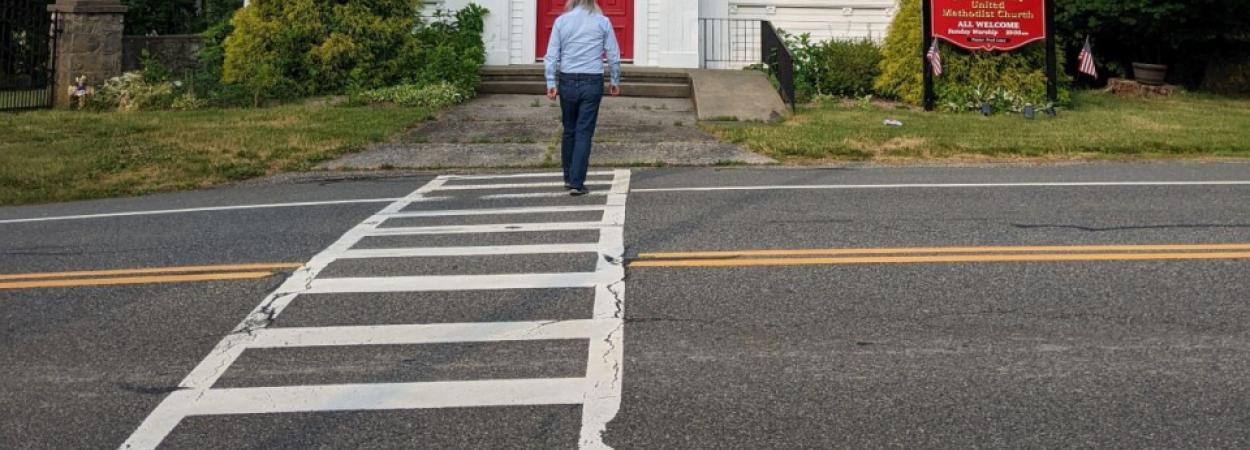
The Role of Bus Stop Features in Facilitating Accessibility
A bus stop can be anything from a simple signpost stuck in the grass, to a comfortable shelter with seating and paved access to the sidewalk. How much do these features impact bus ridership?
A NITC research project led by Keith Bartholomew of the University of Utah and Arlie Adkins of the University of Arizona evaluated the impacts on ridership of improved facilities at bus stops along the number 41 bus line in Salt Lake City. The results had significant implications for transit agencies.
The study, co-funded by the Utah Transit Authority (UTA), found a 5.9% increase in boardings after improvements were made to the series of bus stops in Salt Lake City - compared to only a 1.7% overall increase in boarding at stops in a control group that were not improved.
The bus stop improvements – which include adding shelters and seating as well as stronger compliance with the Americans with Disabilities Act (ADA) – also correlated with a decrease in ADA paratransit demand in the area. These two results—increased boardings on scheduled-service buses and reductions in paratransit use—suggest that perhaps some ADA paratransit riders were switching to scheduled-bus service for at least some of their trips. To test this possibility, the team assessed how often buses were deploying their wheelchair ramps. They found that increased ramp deployments were, in fact, significantly associated with bus stops that had been improved.
The changes in ADA paratransit demand, however, were much smaller in magnitude than the overall change in bus stop boardings: In other words, the data demonstrate that improved stops are appealing to riders of all abilities, not just those who qualify for ADA paratransit.
These implications informed UTA's approach to bus stop improvements, and offer evidence that can support the need for increased accessibility features for other transit agencies as well.
Back to top
Data, Modeling, and Tools
We need better data and tools for decision-making. Our research advances the collection, methodology, and analysis of multimodal data that supports professionals and researchers in understanding and predicting human travel behavior in order to optimize those systems for both the providers and users. These new models and tools examine the implications of changes to the system on a range of outcomes including equity, the environment, and health. Download the full literature review of NITC research in multimodal data and modeling here, or you can download our two-page summary here.
See below for more outcomes of NITC research improving transportation data and tools, to help practitioners create research-driven solutions.
Strengthening the Predictive Powers of VisionEval: NITC's Impact On Scenario Planning
VisionEval is an open-source modeling framework used by transportation agencies all around the country to evaluate the long-term impacts of various transportation, land use, and policy scenarios. Over the past several years, the US Department of Transportation-funded National Institute for Transportation and Communities (NITC) has helped to refine VisionEval, incorporating new travel modes such as car sharing, bike sharing, ride hailing, and autonomous vehicles, as well as active transportation activity.
"My PhD advisor used to say that VisionEval is a SIM City for professionals," said Liming Wang, referring to the computer game in which players build and manage a virtual city. By anticipating the effects of different policies and investments, it serves as a decision support system for planners, policymakers and the general public. Wang has led several NITC research efforts to refine and enhance VisionEval.
HOW HAS NITC IMPROVED VISIONEVAL?
Expanding the power of VisionEval offers a multitude of benefits for state and regional planning. In addition to Liming Wang, NITC researchers Kelly Clifton, Jennifer Dill, Jenny Liu, Alex Bigazzi, Yao-Jan Wu, Joseph Broach and Kristina Currans have all worked to grow VisionEval's capabilities in various ways.
Incorporating Bicycle Activity and Vehicle Travel Reduction from Bicycle Infrastructure
Principal Investigators: Joe Broach, Portland State University; Kristina Currans, University of Arizona
In existing versions of VisionEval, increases in cycling and reductions in vehicle miles traveled (VMT) were not sensitive to improvements in bicycle network connections. This project was significant because the analysis provided a framework that linked such infrastructure changes to bike travel, accessibility, and VMT outcomes in a way that could also be incorporated into the VisionEval planning tool. This could significantly improve the representation of bicycle travel behavior for scenario planning purposes.
Land Use and Transportation Policies for a Sustainable Future with Autonomous Vehicles
Principal Investigators: Liming Wang, Portland State University; Yao-Jan Wu, University of Arizona
Even though there are tremendous uncertainties in the timing and evolution path of the Autonomous Vehicles (AV) technology, it may become a likely reality within most MPOs' long-range regional transportation plan horizon of twenty years. This project studied the possible impacts on travel and land use of emerging AV technology and focuses on advancing this innovative mobility option by making sure it serves the greater good of building sustainable and equitable communities in its adoption. The project also contributed to smart cities research by examining the likely social, economic, and environmental outcomes of integrating AV in our cities and by starting to consider policies and plans to preempt their potential adverse impacts and to ensure that the AV technology improves access for all people.
Incorporate Emerging Travel Modes in the Regional Strategic Planning Model (RSPM) Tool
Principal Investigators: Liming Wang and Jennifer Dill, Portland State University; Kelly Clifton, Portland State University (Now at University of British Columbia)
This project offers help to planners seeking to incorporate emerging travel modes—including car sharing, bike sharing, ride hailing, and autonomous vehicles—into regional travel demand models. The research team completed a nationwide survey and collected data from 1,117 valid participants. The data were examined to learn about their recent travel behaviors, attitude, and their stated preferences about using emerging travel modes when presented along with their chosen mode. The team then developed models using the data from the stated preference choice experiments, along with information from the revealed preferences and socio-demographic characteristics of the survey respondents.
Informed by their earlier NITC-funded research, Wang and Jenny Liu of PSU also worked with the Oregon Department of Transportation (ODOT) to develop a Transportation Cost Index: A Comprehensive Performance Measure for Transportation and Land Use Systems. The index they developed helps DOTs and MPOs to adopt comprehensive measures in the decision process which allow consistent comparison of multimodal performance over time and across geographic areas. It is applicable for monitoring historical and projected trends (benchmarking), evaluating and comparing outcomes from what-if scenarios (scenario evaluation), as well as reporting on current status.
In another ODOT project currently underway, Wang is now working to incorporate that cost index into VisionEval. The research goal is to upgrade the land use model in the current VisionEval implementation and expand its capacity to enable evaluation of transportation and land use policies. The upgrades will improve ODOT’s abilities to evaluate how land use and transportation strategies will affect each other and GHG emissions. In addition, they will greatly improve capabilities for modeling land use and its consequences at a more detailed level, evaluating regional land use strategies, and evaluating the social equity implications of land use and transportation strategies.. Read about that project: Development Of A New VisionEval Land Use Model And Applications To Evaluation Of Climate Strategies In Oregon.
HISTORY AND BACKGROUND
Originally developed by Brian Gregor at the Oregon Department of Transportation (ODOT) in the late 1990s, the open-source code of VisionEval has since been widely adopted and adapted for analysis of multiple factors such as energy consumption, emissions, and travel demand. Its modular design enables users to tailor the model to specific regional or project needs, helping planners make data-driven decisions to shape sustainable transportation systems.
By analyzing energy use, emissions, and fuel consumption under different scenarios, VisionEval helps planners develop strategies to reduce greenhouse gas emissions and meet sustainability targets. It allows transportation professionals to evaluate how policies will affect different communities, particularly underserved populations, by factoring in equity considerations like accessibility and affordability. Since it is an open-source tool, agencies can adopt and modify it as needed for a low cost.
Read more about VisionEval's impacts in a September 2024 summary from Resource Systems Group (RSG), Strengthening Scenario Planning: How VisionEval Helps Planners Quantify the Measures that Matter. Another September 2024 article, this one from PSU's College of Urban and Public Affairs, explores VisionEval's versatility as a strategic planning tool.
Bike-Ped Portal: Making the Most of Nonmotorized Data
In recent years, cities and counties all across the United States have invested in bicycle and pedestrian counters. Having reliable data on non-motorized traffic can help jurisdictions make informed decisions about infrastructure investments, measure the effectiveness of biking and walking initiatives, and improve safety. But having a bike-ped count program is just the beginning. Once counts have been collected, cities face new challenges. How can multiple agencies share data among themselves? How can data be standardized and compared? And what is the most effective way to communicate what the numbers mean? Enter Bike-Ped Portal, the comprehensive non-motorized data management system for manual and automated non-vehicular multi-modal counts housed at Portland State University (PSU).
BikePed Portal was established in 2015 by Transportation Research and Education Center (TREC) researchers at Portland State University through a pooled fund grant administered by the National Institute for Transportation and Communities (NITC).This specialized data lake and management system makes sharing data—within an agency, with partners at other agencies, and with the public—easily accessible. Since its NITC-funded inception, it has grown into a unique national resource for bike and pedestrian data. In recent years, BikePed Portal has gained a dashboard for the national capital region and one for the Portland-Vancouver region, allowing users to see all the data for those regions in one place.
Agencies who use Bike-Ped Portal may have counters from different vendors, or use more than one platform to manage data. That's why Bike-Ped Portal is able to accept data in multiple formats, whether that's a spreadsheet with manual counts, output from automated counters, or APIs such as EcoCounter. Once the system receives new data, it is converted into a standardized format. Quality control tools are available, along with the ability to add correction factors and data annotations.
Bike-Ped Portal does more than reduce the time and effort required to manage multiple data sources, format, standardize, validate, and share data openly. TREC's transportation data team can also build custom analytical tools and dashboards to help data tell a story. Transportation Data Program Manager Tammy Lee, and Senior Research Associate Basem Elazzabi, who head up TREC's transportation data program, work with agencies to build tools which meet their specific needs, help reduce redundancies and standardize reporting.
Data Fusion: Predicting Bicycle Volumes Using Machine Learning
In a series of research projects funded by the National Institute for Transportation and Communities (NITC), researchers have been developing new approaches that combine conventional and emerging data sources to estimate bicycle volumes. Having accurate bicycle volumes can help state departments of transportation (DOTs) and other agencies to prioritize projects, plan and design new bicycle infrastructure, and conduct safety analyses.
Traditional permanent and short-term counting methods have a high degree of accuracy but are limited to certain locations or short periods of time, while crowdsourced data (such as Strava or StreetLight) can cover a wider area but with less accuracy. Fusing the two methods together–potentially with the use of deep learning algorithms–is a promising way to get the best of both.
The latest report to come out of these efforts, by Sirisha Kothuri, Banafsheh Rekabdar and Joe Broach of Portland State University, pushed the needle forward on using advanced techniques to extrapolate data over a large transportation network. Two PSU graduate students also worked on the project: Saba Izadkhah, who is working toward a PhD in computer science, and Andrew Wagner, a computer science masters student.
"These methods are still evolving, and it's still in the research phase. But I think the time is not far off when we will start using these methods as more mainstream," Kothuri said.
The techniques have been continually developed and refined since this work first began in 2018. At that time, NITC launched a pooled fund project with support from the DOTs of Oregon, Virginia, Colorado, Utah, and the District of Columbia, as well as Central Lane MPO and the Portland Bureau of Transportation. With matching funds from NITC, those agencies came together to fund the initial project Exploring Data Fusion Techniques to Estimate Network-Wide Bicycle Volumes, with a research team led by Kothuri made up of researchers from PSU and the University of Texas at Arlington.
The new NITC report published this month, Improving the Accuracy and Precision of Bicycle Volume Estimates Using Advanced Machine Learning Approaches (PDF), shows that the latest models offer increased accuracy. A paper based on this work was presented at the Institute of Electrical and Electronics Engineers' International Conference on Artificial Intelligence x Science, Engineering and Technology at the beginning of October.
"We know that for pedestrians, injuries and fatalities are at an all time high. Bicyclist safety is also of top concern. So these estimates are really critical for agencies right now," Kothuri said.
HOW DOES IT WORK?
The researchers train the model on existing count data from certain locations, then use that trained model to predict volumes at locations where there is count data that the model hasn't seen. They then compare the model's predictions with the actual count data to see how accurate it is.
Using long short-term memory networks and deep neural networks, the method involves the combining of static variables—such as network characteristics, demographics, and land use— with dynamic crowdsourced data and count data from different regions. The research has shown that crowd-sourced data alone cannot replace traditional count data. For this method to work, you need both.
Regional data is key to the success of the model: the more local count data you have, and the more you can train the model to predict based on the local data, the better the accuracy will be.
The model also fared better when using Monthly Average Daily Bicyclists (MADB) as a target, rather than Annual Average Daily Bicyclists (AADB), because breaking each counter down into monthly units gave it more data points.
"Basically, the more data it has, the smarter it gets," said Rekabdar.
For more details, watch a 2022 research highlight video about the original pooled fund study, or a recorded 2022 Webinar: Exploring Data Fusion Techniques to Derive Bicycle Volumes on a Network.
If you have questions about any of the research on this page or would like more information, email us at asktrec@pdx.edu.
Back to top


 Kyu Ri Kim
 Allison Kirkpatrick
  Julay Leatherman-Brooks
 Jiahui Ma
 Jules Mai Plotts
 Saurav Kumar Singh