
Students in Portland State University’s Urban and Regional Planning program are helping imagine safer, more welcoming streets across Portland.
As part of the Active Transportation Planning–Design Studio, student teams worked directly with community partners to identify solutions that are both realistic and affordable. Last month, three student groups presented final projects that propose improvements for walking and biking in three Portland neighborhoods. The projects were developed through Better Block PSU, a program that connects PSU students with local partners to test ideas and advance people-centered street design.
Together, the projects show how small, strategic changes can make a meaningful difference for safety, accessibility, and neighborhood connectivity.
Northeast San Rafael Street: Improving Safety and Accessibility
One team focused on Northeast San Rafael Street between NE 111th and 122nd avenues—an important east–west neighborhood route serving the Parkrose Heights, Woodland Park, and Russell neighborhoods in East Portland.
The corridor connects residents to schools, parks, transit, and nearby destinations, including Sacramento Elementary School. Many people who live nearby are older adults or children, who are more likely to rely on walking and transit and are especially vulnerable to unsafe street conditions. The area is also more racially diverse than Multnomah County overall and experiences higher transportation disparities.
Today, San Rafael Street lacks basic pedestrian infrastructure. While an experimental design using “advisory shoulders” was installed in 2022, students found it confusing, uncomfortable, and underused. Narrow paved space, unclear signage, loose gravel, and poorly defined walking areas make the street difficult to navigate—especially for people using mobility devices.
The student team—Future Churchhill, Leo Parsons, Nick Pelster and Elias Peters—set three goals:
- Improve safety and comfort for vulnerable road users
- Strengthen pedestrian connections
- Propose designs that are affordable and realistic to implement
Using guidance from the Portland Pedestrian Design Guide, the team developed three design options:
- Alternative 1: Pedestrian Shared Street
This lowest-cost option narrows the roadway and lowers speeds to 15 mph, signaling that pedestrians can use the street. While inexpensive, it does not significantly improve accessibility or provide separation from traffic. - Alternative 2: Safer Shoulder with Painted Buffer
This option adds a paved pedestrian walkway separated by a painted buffer. It improves accessibility and comfort but still lacks physical protection. - Alternative 3: Protected Safer Shoulder (Recommended)
The recommended design adds a physical barrier between pedestrians and traffic, improving clarity, safety, and accessibility while strengthening connections to the broader walking network.
The team emphasized that incremental, well-planned investments can deliver major safety benefits without requiring large capital projects.
East Burnside Street: Safer Crossings on a Busy Main Street
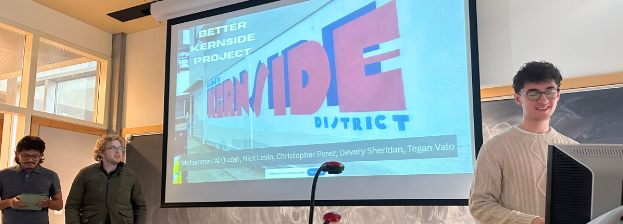
Another team of students—Mohammed Al Qudah, Nick Levin, Christopher Perez, Devery Sheridan, and Tegan Valo—tackled East Burnside Street between 20th and 28th avenues, a lively but challenging corridor lined with restaurants, bars, and jobs near the Kerns and Buckman neighborhoods.
Although Burnside is designated by PBOT as a Neighborhood Main Street, it currently lacks consistent crossings and traffic-calming features. The project builds on earlier PSU student work through the Better Burnside Project Pathway, helping move ideas closer to implementation.
The team focused on two priorities: improving pedestrian crossings and rethinking how street space is allocated. They explored improvements to 28th Avenue in addition to Burnside.
Proposed crossing improvements include:
- New or upgraded crosswalks, pedestrian refuge islands, curb extensions, and improved lighting at key intersections
- A protected, push-button pedestrian signal at 24th Avenue to improve access to the bike network and make crossings safer
- Quick-build curb extensions using materials like planters to slow turning vehicles and shorten crossing distances
For lane reconfiguration, the students evaluated two options. Their recommended alternative removes the center turn lane to create protected, bi-directional bike lanes. This design makes crossings shorter and safer for pedestrians while improving bike connectivity along one of Portland’s busiest corridors.
The team suggested implementing lane changes after crossing upgrades and noted that the future Burnside Bridge closure—expected no earlier than 2029—could provide an opportunity to make changes while traffic volumes are lower.
Southeast Henry Street: Improving Access on Unpaved Roads
A third team—Ethan Morehouse, Joe Kortenhof, James Shelstad, Malcolm Bagnall, and Terrence Epperson—focused on Southeast Henry Street in the Woodstock neighborhood, where unimproved gravel roads create serious challenges for people walking, biking, or using mobility devices—especially during the rainy season, when large puddles form.
These conditions make it difficult to reach Lewis Elementary School and other neighborhood destinations safely. At the same time, residents value the street’s low traffic volumes and neighborhood feel.
Rather than proposing full paving—which would be costly—the students explored ways to improve year-round mobility while preserving what neighbors value. Their goals included better stormwater management, improved ADA accessibility, and dedicating more space for people walking.
By strategically reallocating right-of-way, strengthening drainage, and connecting existing pedestrian infrastructure, the team identified ways to extend the life of the street surface and improve safety without major reconstruction.
Learning Through Partnership
Across all three projects, students emphasized collaboration, affordability, and real-world constraints—reflecting the hands-on learning approach at PSU.
The teams acknowledged support from the Transportation Research and Education Center (TREC), Better Block PSU, community partners at PBOT and neighborhood associations, and course instructor Derek Abe.
Together, these projects highlight how student-led research and design can support Portland communities—turning classroom learning into practical ideas that help create safer, more accessible streets for everyone.
Portland State University's Transportation Research and Education Center (TREC) is a multidisciplinary hub for all things transportation. We are home to the Initiative for Bicycle and Pedestrian Innovation (IBPI), the data programs PORTAL and BikePed Portal, the Better Block PSU program, and PSU's membership in PacTrans, the Pacific Northwest Transportation Consortium. Our continuing goal is to produce impactful research and tools for transportation decision makers, expand the diversity and capacity of the workforce, and engage students and professionals through education, seminars, and participation in research. To get updates about what's happening at TREC, sign up for our monthly newsletter or follow us on social media.

