
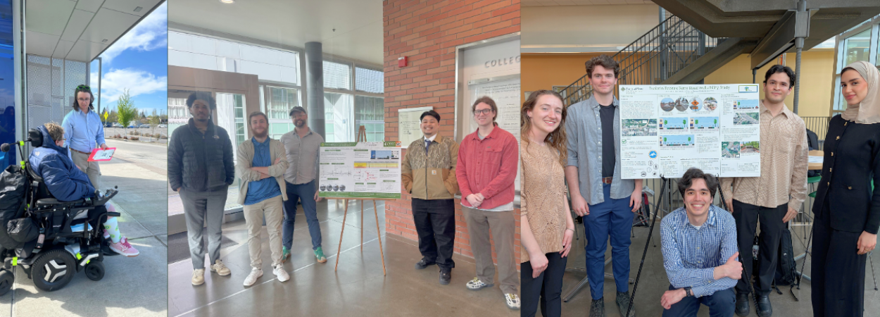
Left to right: MURP student working with C-TRAN to improve bus stop ADA accessibility speaks with a motorized wheelchair user at a bus stop; the Kernside Traffic Control Plan team gathers by a poster of their project; the Tualatin Boones Ferry Walkability team also gathers around their project poster.
Earlier in June, Portland State University’s Civil and Environmental Engineering (CEE) undergraduate students and Masters of Urban and Regional Planning (MURP) students concluded the spring quarter with final project presentations. A handful of the final projects focused on transportation, addressing issues ranging from ADA accessibility and street design to walkability and the Green Loop.
Master of Urban Planning (MURP) Workshop Projects
Bus Stop Accessibility Action Plan for C-TRAN
Team: Grace Alston, Michelle Auster, Zoe Beckley, Noah Crawford, Ryan Gallo, Angelique Wallmann
C-TRAN is the regional transportation authority serving Clark County, Washington. Roughly 33% of C-TRAN’s bus stops do not meet the Americans with Disabilities Act (ADA) standards. Accessible bus stops are the foundation of a safe, reliable, and equitable transit network, and inaccessible infrastructure creates significant barriers to ridership. C-TRAN partnered with PSU graduate students to develop a Bus Stop Accessibility Action Plan (BSAAP). This BSAAP will be the north star of C-TRAN’s ADA Transition Plan and provides C-TRAN with a flexible decision-making framework to prioritize bus stop accessibility upgrades.
Through in-depth technical analysis, best practice research, and robust community engagement, students developed the central tool of the BSAPP: the prioritization matrix. The matrix produces a comprehensive accessibility score for every bus stop in C-TRAN’s network, taking into account numerous experiential, environmental, social, and network performance metrics which are paired alongside community feedback. Importantly, the BSAAP is accountable to the community’s desires and is the first long-term and renewable vision of accessibility upgrades for C-TRAN. This plan will not only help C-TRAN meet ADA standards; it will imprint the value of accessibility in public transportation and provide a roadmap to go above and beyond the minimum standard.
Past MURP Workshop projects can be found on PDXScholar.
Civil and Environmental Engineering (CEE) Capstone Projects
Kernside's Traffic Control Plan
Team: Taran Bradley, Anthony Cotham, Stefan Fricke, Jay Salumbides, Eoan Tipikin
The Kernside Traffic Control Plan team focused on East Burnside St. between SE 22nd and SE 28th Avenues, a vibrant area in the Kerns neighborhood with significant pedestrian activity but marked by high vehicle speeds, frequent collisions, low nighttime visibility and insufficient pedestrian infrastructure. Working with the Kerns Neighborhood Association, Better Block PDX, and TREC, the team developed a proposal for traffic-calming measures and infrastructure upgrades, to address these safety concerns and enhance connectivity.
The team proposed a temporary Traffic Control Plan (TCP) along East Burnside to encourage higher foot traffic and a road diet to encourage safe driving behavior. This project also allows the community to assess the impact of potential permanent changes for future consideration by the Portland Bureau of Transportation (PBOT). The proposed TCP will remediate these issues while also increasing transit access along one of the highest TriMet ridership routes.
Tualatin Boones Ferry Walkability Study
Team: Afnan Ajina, Emmanuel Castaneda, Ethan Frederick, Kyle Petchey, Natalie Smith
The City of Tualatin is currently implementing their Downtown Revitalization Project which is meant to encourage development. The area of the study is focused on SW Boones Ferry Road, which passes through commercial areas, residential areas, and the upcoming Tualatin River waterfront park. Despite road and facility implementations, the study area suffers from poor road and path connectivity with a lack of provisions and amenities for pedestrians. The Tualatin River Greenway Trail currently ends in the study area and connects to neither downtown nor the park, leaving users without an outlet.
The group worked with the City of Tualatin Engineering Division of the Community Development Department to accomplish two main goals: redesign Boones Ferry Road to prioritize pedestrians and connect the Tualatin River Greenway Trail to the future waterfront park. Overall they focused on increasing connectivity and creating more space and a sense of safety for pedestrians. To achieve these goals, the team proposed widening sidewalks, raising bike lanes and cross walks, adding physical barriers between bikers, walkers, and cars, and parklets spread about the corridor. They also designed a pedestrian tunnel that passes under Boones Ferry Road.
The Green Loop - PSU/South Waterfront Segment
Team: Reilly Aldrich, Lucas Curtsinger, Owen Kalas, Estephano Munoz Soto, Ella VanCleave
The Green Loop is a planned 6-mile pathway in Portland that surrounds the Willamette River. The loop is intended to promote walking and biking, support economic development, and reduce reliance on vehicles by connecting neighborhoods and districts around central Portland. This project focuses on the PSU/South Waterfront segment of the loop, specifically, the connection between SW Harrison St. and S Harbor Dr. to the intersection of SW 4th and College St. This segment lacks a clearly defined, continuous route for cyclists and pedestrians, which could confuse the Green Loop users.
To address this issue, four proposed routes connecting these two streets were evaluated: Lincoln St., Harrison St., Lovejoy Fountain, and the I-405 Oregon Department of Transportation right-of-way. Each alternative was assessed based on criteria provided by PBOT, including feasibility, comfort, and compatibility with existing transportation modes and businesses. Ultimately, Lincoln Street was selected as the preferred alternative due to its direct alignment, existing infrastructure, supportive adjacent land uses, and relatively gentle slope. Throughout the SW Lincoln St. section of the Green Loop, several key design features were added to promote usage, enhance safety, and create a more recognizable path for pedestrians and cyclists.
Portland State University's Transportation Research and Education Center (TREC) is a multidisciplinary hub for all things transportation. We are home to the Initiative for Bicycle and Pedestrian Innovation (IBPI), the data programs PORTAL and BikePed Portal, the Better Block PSU program, and PSU's membership in PacTrans, the Pacific Northwest Transportation Consortium. Our continuing goal is to produce impactful research and tools for transportation decision makers, expand the diversity and capacity of the workforce, and engage students and professionals through education, seminars, and participation in research. To get updates about what's happening at TREC, sign up for our monthly newsletter or follow us on social media.

