
Electronic Wayfinding for Visually Impaired Travelers: Limitations and Opportunities
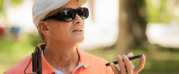
It's 2019, and with the explosion of mobile technology that has affected all other areas of life, it would seem to be a golden age for people living with visual impairments. Like never before in history, blind, deaf-blind, and low-vision individuals can access a plethora of mobile apps offering a range of services to aid in navigation and wayfinding. But the words "explosion" and "plethora" hint at an underlying problem: there are so many different apps, each one addressing only a segment of their mobility needs.
New research led by Martin Swobodzinski and Amy Parker of Portland State University seeks to provide pathways to improving the quality of life of people who experience disproportionate impediments to their mobility, through inclusive pedestrian navigation in an urban environment. Funded by a “Small Starts” grant from the National Institute for Transportation and Communities, their final report offers an overview of existing mobile wayfinding technology as well as insights from focus groups: some with blind, deafblind, and visually-impaired participants, others with professional Orientation and Mobility instructors.
ONE APP TO SERVE THEM ALL
One of the biggest takeaways from the focus groups was the idea that many users would prefer integration, rather than proliferation when it comes to mobile wayfinding apps.
"I wish that all the apps [...] would honestly do a think tank [...] and come up with this app that combines each of their features into this collaborative, cohesive thing that will work for the blind community," one visually impaired participant said.
As many navigation apps have downfalls, it appears that blind travelers use multiple sources as a means of navigation. Several apps were identified as being used simultaneously for different aspects of the journey (for example, BlindSquare used for intersection navigation in combination with Apple or Google maps for wayfinding).
Switching between the different apps, relying on auditory and haptic feedback, adds an element of stress and confusion. Meanwhile, running these competing applications is using up the smartphone's battery, which could leave a user stranded without assistance.
From a user experience perspective, it appears that some app developers have not actually tried their own apps without the aid of sight. One participant suggested app developers get a "sleep shade, and wear that while traveling. Because then they could get a full understanding what it is like with the anxiety and the stress."
CURRENT STATE OF TECHNOLOGY
The research team led by Swobodzinski and Parker created an annotated inventory of existing smartphone-based electronic travel aid technology–listing all the apps, the functions they serve, and their price tags. Some of the higher priced apps come with a monthly service plan, with sighted help available at the touch of a button; others rely on AI to interpret visual data and provide information.
The landscape of mobile wayfinding apps is characterized by fragmentation, and leaves room for improvement across the complete trip in several areas:
An artificial separation between indoor and outdoor travel prevails. Focus group participants indicated a need for turn-by-turn, indoor/outdoor navigation that makes the journey and transitions between indoor and outdoor spaces as seamless as possible.
Deaf-blind participants specifically elaborated on interface-related shortcomings of the wayfinding apps that they have access to.
Several participants noted that an app that identifies streets or landmarks as they are passing by while on public transportation would be helpful.
Many of the existing apps work best in an urban environment; they should be developed to be equally useful in rural and suburban areas.
Further suggestions for improvements as identified by the focus groups are the addition of turn-by-turn navigation, notification of road closures or obstacles in the path, and clearer descriptions of intersections.
NEXT STEPS
In the latest round of NITC funding, Swobodzinski and Parker received a grant to continue this work in a larger capacity. Their next project, Seamless Wayfinding by Individuals with Functional Disability in Indoor and Outdoor Spaces: An Investigation into Lived Experiences, Data Needs, and Technology Requirements, will employ a mixed-method design to develop a saliency feature inventory for supporting effective wayfinding design for individuals with visual impairments, blindness, and deafblindness. This project promises to drive forward the development of standards and innovation in mobile wayfinding. Further, it stands to provide planners, designers, educators, researchers, practitioners and community members a working inclusive model to evaluate and scale on campuses and in communities.
For more information (and immediate takeaways) about what transportation professionals can do to help the visually impaired get around, check out a June 2019 seminar ‘Challenges and Considerations for Travelers Who Have Visual Impairments: What Can You Do to Support Their Independence?” with Dr. L. Penny Rosenblum of the Department of Disability and Psychoeducational Studies at the University of Arizona.
This research was funded by the National Institute for Transportation and Communities, with additional support from Portland State University.
RELATED RESEARCH
To learn more about this and other NITC research, sign up for our monthly research newsletter.
- Seamless Wayfinding by Individuals with Functional Disability in Indoor and Outdoor Spaces: An Investigation into Lived Experiences, Data Needs, and Technology Requirements
- How Can Interdisciplinary Teams Leverage Emerging Technologies to Respond to Transportation Infrastructure Needs? A Mixed-Methods Evaluation of Civil Engineers, Urban Planning, and Social Workers’ Perspectives
- How Do Stressed Workers Make Travel Mode Choices That Are Good For Their Health, Safety, and Productivity?
The National Institute for Transportation and Communities (NITC) is one of seven U.S. Department of Transportation national university transportation centers. NITC is a program of the Transportation Research and Education Center (TREC) at Portland State University. This PSU-led research partnership also includes the Oregon Institute of Technology, University of Arizona, University of Oregon, University of Texas at Arlington and University of Utah.