When people talk about Portland, they talk about weather and bicycling. Judging by the Transportation Research Board annual meeting in Washington, D.C., researchers are looking into the same two things.

Bikes, of course, draw more interest at a transportation conference than in other circles. Here, Portland continues to draw attention: A single day’s poster session featured no less than seven papers that use Portland as a bicycle research laboratory.

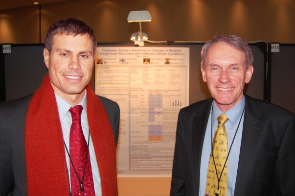
The examination of bicycling and weather drew research looks from around the continent. A paper with authors from OTREC and the Institute of Transport Studies at Monash University, Australia, looked at how well different factors, including weather, affect bicycling in Portland, Ore., and Brisbane, Australia.

Light rain, for example, had little effect on bicycling in Portland, said Portland State University’s Miguel Figliozzi, one of the paper’s authors. The drop in ridership was four times as great in Brisbane on drizzly days.

“We’re used to light rain, so the difference is very small in Portland,” Figliozzi said. “In Australia, maybe they are not used to that.”

Geoffrey Rose of Monash University, another author on the paper, said the paper could help transportation decision makers understand and respond to effects of weather on active transportation, particularly as they deal with climate change. “This helps to understand the effects (of weather) on cycling today and what we can do to perhaps...

Read more
In transportation funding decisions, you don’t count until you’re counted. That fact can lead to cyclists and pedestrians, often overlooked in traffic counts, getting less than their share of transportation money. OTREC hosted a conference Sept. 15 to address that problem.

“Without the data, you have an incomplete picture of how the (transportation) system is being used,” said OTREC researcher Chris Monsere, the conference organizer. “And it’s easier to make the case for resources if you know how the system is being used.”

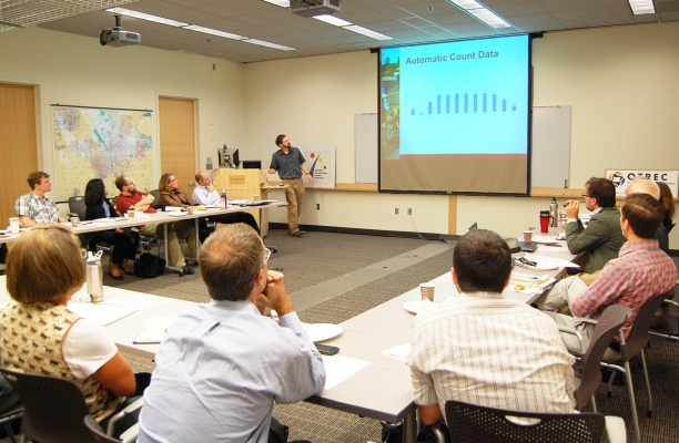
The conference, called the “Bike and Pedestrian Program Information Exchange & Technology Transfer Summit Meeting,” brought together officials from local and state transportation agencies and consultants to share features of the best counting programs and technology. The forum helped bridge a gap between people who count motor vehicles and those who count bicycle and pedestrian traffic.  

“We wanted to raise a little awareness of both sides of the equation,” Monsere said. “There are things both can learn from the other.” <All presentations available  for download at the end of this article>

Nonmotorized counting programs often get large numbers of motivated people involved quickly and have a strong network for distributing results of counts. Motorized counts tend to be more systematic and uniform.

The motorized traffic counts have a jump on their non-motorized counterparts, Monsere said. That’s largely a result of...

Read more

The Initiative for Bicycle & Pedestrian Innovation at Portland State University hosted a weeklong boot camp on bicycle and pedestrian design geared toward transportation planners, engineers and other public officials.

“There’s a dearth of knowledge among most practitioners,” said IBPI Director Lynn Weigand. “Most engineering and planning curricula don’t include any elements of bicycle and pedestrian planning and design.

“There’s an increased demand for alternatives to make communities safer for biking and walking.”

The intensive course, Aug. 15 to 19, featured classroom sessions, discussions, daily field tours of Portland facilities and project applications. Public- and private-sector experts served as program instructors.

For attendees, the program offered the chance to learn how various active transportation concepts fit together in one community.  Tyler Palmer, a division manager with the Moscow, Idaho, public works department, came looking for guidance on his city’s multimodal transportation master plan.

“This is going to be really helpful for us in steering that process,” Palmer said. “It will help give us the tools we need to analyze our system and see what works best.”

Jumping into a master plan without...

Read more

On May 25, OTREC Director Jennifer Dill traveled to Vancouver, B.C. to talk about the impact of new bike lane facilities in downtown Portland. The conference, Changing Lanes, was about improving bike-car relationships on Canada’s roads. The conference attracted leading international and domestic experts to discuss issues and research on bike/car safety, infrastructure and the business opportunities and costs of increasing bike use in cities.

Dill participated in the panel discussion “Building A Better Connection: How Can We Build Infrastructure That Supports A Smoother Relationship For Drivers and Cyclists” (Watch the discussion here). She was joined by Erick Villagomez, professor at the University of British Columbia School of Architecture; Luci Moraes, transportation planner for the city of Surrey, B.C.; Darryl Young, urban planner and steering committee member for the Toronto Coalition for Active Transportation; and Councilor Geoff Meggs of the city of Vancouver.

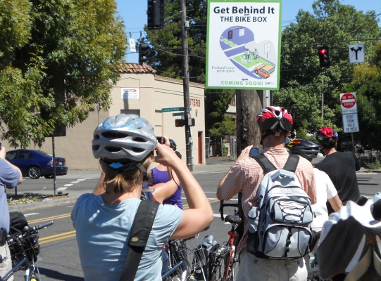
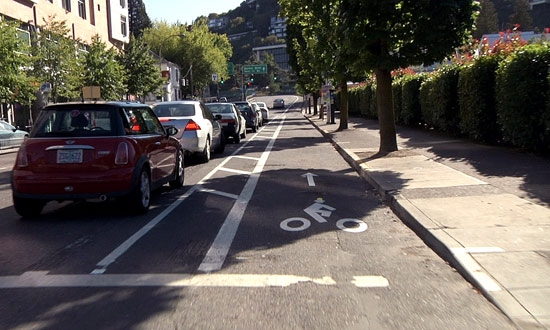
Dill presented research performed by OTREC on the reactions of cyclists, motorists and pedestrians to new bike facilities. In the summer of 2009, the city of Portland installed a cycle track on SW Broadway near PSU’s campus which served as the primary study area. Researchers surveyed users in the area to gauge their reactions.

“Overall,...

Read more

Fixing a community’s pedestrian and bicycle infrastructure issues could be as simple as turning on one’s smart phone in the future. At least that’s the hope of OTREC researchers Marc Schlossberg, Ken Kato, Dana Maher, Cody Evers, and Christo Brehm of the University of Oregon.

In the report, Transportation Planning Through Mobile Mapping (Read The Full Report Here), researchers developed and tested the Fix This Tool, a smart phone application that allows community members to assess problems within their transportation environment. The goal was to create a tool that could be affordably distributed to communities across the country so pedestrians and cyclists can actively participate in improving their means of transportation.

As the desire for reduced carbon emissions, reduced congestion, and reduced public spending on transportation infrastructure grows, many state and local governments are looking to encourage walking and bicycling in their communities as an alternative to cars. However, current data on pedestrian and bike networks are limited and there is little understanding on what constitutes appropriate bike and pedestrian infrastructure. To remedy this, local governments must engage residents to find out challenges current users face and what infrastructure is needed to increase biking and walking by residents.

Previous OTREC research developed a tool built on a GIS platform (...

Read more

While the national parks system may have some of the most natural areas in America, there’s nothing natural about how most Americans travel through them: by car.

Todd Johnson, an OTREC graduate research assistant, is hoping to change that for at least one state park. The Eno Transportation Foundation recently chose Johnson for a year-long assignment to find ways to reduce traffic congestion at Arches National Park near Moab, UT.  Every year, Eno puts out five assignments throughout the country to improve transportation at national parks and monuments.

Johnson, a Master of Science student in civil and environmental engineering at Portland State University, previously worked as a transportation interpreter at Rock Mountain National Park, encouraging people to take a shuttle service rather than driving.  He has a similar goal for his stint at Arches.

“We want to get people out of their cars,” Johnson said. “Right now when the parking lots fill up, people park on the side of the road, creating a safety hazard and diminishing the beauty of the park. I will help with implementing solutions to deal with congestion using (Intelligent Transportation Systems) and social media.”

Johnson, an avid cyclist, will also be looking at encouraging alternative forms of transportation through Arches. The park is looking to construct more hiking and biking trails to prevent visitors from driving from one attraction to another, Johnson said. Currently, the park’s roads...

Read more

Every year, graduate and undergraduate students from Portland State University’s Toulan School of Urban Studies and Planning perform projects to aid urban planning efforts in local communities. On Tuesday, May 31, several students from PSU’s Master of Urban and Regional Planning (MURP) program took to the podium to present what they had accomplished after nearly six months of hard work.

When Amy Hesse, a graduate student in the MURP program, traveled to Redmond to learn more about efforts to encourage bicycling in the eastern Oregon community, she found plenty of people interested biking. But she also found that many were not doing so because they felt unsafe. Hesse, along with students April Cutter, Reza Farhoodi and Spencer Williams, developed a project called B-Spoke which sought to create a bicycle refinement plan for the city of Redmond.

“Our goal was to build off the city’s existing transportation system plan by identifying assets and barriers to increased ridership,” said Hesse. “People told me, ‘I don’t feel safe’ and we looked for new ways to overcome that. It wasn’t so much telling (Redmond locals) what they should do, but seeing what we could learn from them.”

While Redmond had many assets to cycling, including existing bike trail systems, a lack of east-west connectivity and dangerous highway crossings prevented many from biking more frequently, or at all, outside of recreation. Women were the gender with the most interest in cycling, but...

Read more
Read more

As a bicycle and pedestrian planning consultant, it bothered Robert Schneider that no one seemed to know exactly what made people choose to walk or bicycle. So he set out to change that.

Now a doctoral candidate from the University of California Berkeley, Schneider will share what he found out during a seminar Friday in Portland.

Working on projects including the Seattle Bicycle Master Plan, Schneider always sought a solid explanation for people’s transportation choices. “There was a great interest in walking and bicycling, and communities were doing more planning for those modes,” he said. “But there was also a big need for more detailed research and an understanding of what motivates people to walk and bicycle.”

Those motivations make up Schneider’s dissertation research. He developed a five-step theory on how people choose travel modes, noting that walking and cycling could be promoted at each step: awareness and availability, basic safety and security, convenience, enjoyment, and habit.

To develop the theory, Schneider surveyed 1,000 people at 20 San Francisco Bay Walgreen’s stores in 2009 and held 26 follow-up interviews the next year. He found an association between shorter travel distances and both walking and cycling. He also found that people who walk or bicycle report...

Read more

In many cases, living in suburbia means relying on an automobile for most trips, even short trips to nearby stores. If housing developments incorporated better paths and sidewalks, however, would anyone use them?

Researcher Nico Larco found that people who live in well-connected developments are significantly more likely to walk and bicycle than those in developments only accessible by automobile. He details his findings in this OTREC report.

Larco, an assistant professor of architecture at the University of Oregon, found that people who live in well-connected developments walked to their nearby commercial strips nearly twice as often as did people in less-connected developments. In addition, a greater percentage of residents in well-connected developments reported sometimes walking or cycling.

Despite suburbia’s reputation for large single-family homes, more than a quarter of suburban housing units are higher density. In fact, the suburbs are home to more than 9 million multifamily housing units, with 5 million more projected for the last 20 years. Although these units tend to be near commercial centers, a lack of pedestrian and bicycle infrastructure makes trips using these modes difficult.

For this research project, Larco developed criteria for measuring connectivity in trips taken from, to and through multifamily suburban developments. Studied developments were rated as “well...

Read more

Pages