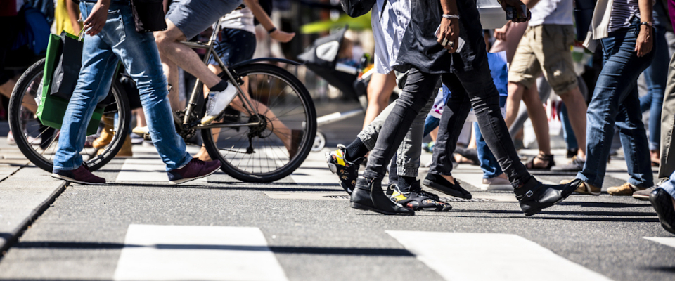
Over the past several years, in a series of research projects, researchers at Portland State University (PSU) have been developing a new approach to estimate active transportation volumes using machine learning.

This emerging method, which can predict how many people will be biking or walking on any given road, trail or segment of a transportation network at any time, offers promising applications for transportation agencies and state departments of transportation (DOTs). These organizations can use accurate bicycle and pedestrian volume information to track changes over time, prioritize projects, plan and design new infrastructure, conduct safety analyses and estimate public health impacts.

"These methods are still evolving, and it's still in the research phase. But I think the time is not far off when we will start using these methods as more mainstream," said Sirisha Kothuri of the Maseeh College of Engineering and Computer Science, the lead researcher on this series of projects.

The method Kothuri and other researchers are developing is referred to as "data fusion" because it involves combining multiple data sources, including traditional permanent and short-term counting methods as well as newer crowdsourced data streams from entities like Strava and Streetlight.

HOW DOES IT WORK?

Traditional permanent and short-term counting methods can directly provide counts, but are limited to certain...

Read more

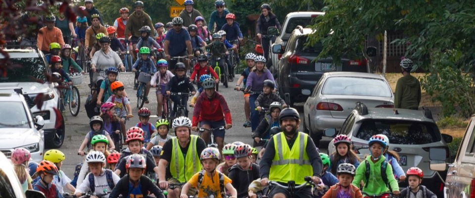
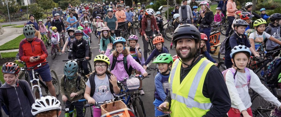
The Bike Bus movement is gaining momentum. All over the country, rain or shine, groups of children with adult supervision are hopping on bikes to ride to school together, and the new organization Bike Bus World, led by Coach Sam Balto, has received official nonprofit status.

Last week, the U.S. Department of Transportation announced a $1.1 million federal grant from the Safe Streets and Roads for All (SS4A) program was awarded to Metro. The funds will be used to boost walking school bus and bike bus programs in north Portland. Read more about the new award on BikePortland.

Benefits of the Bike Bus go beyond physical activity: It's an opportunity for kids and parents to socialize, have fun, start the day on a positive note, and save time on driving, parking, and waiting in school dropoff lines.

According to Portland State University (PSU) researchers, bike buses could be the missing puzzle piece required to complete a robust active...

Read more

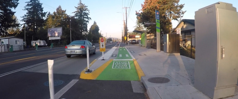
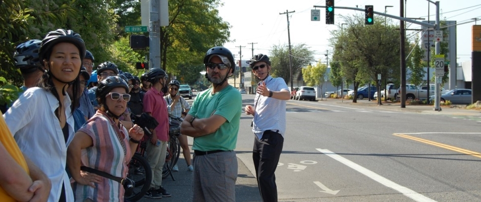
Portland State University (PSU) researchers have partnered with TriMet to evaluate the design of a new shared-use bus platform that incorporates a sidewalk-level bike lane. The project, FX2 Shared Bicycle & Pedestrian Platform Evaluation, assessed how well the new design is working for transit riders and other road users along Portland's Southeast Division Street.

The most common bus and bike lane design typically has a bike lane directly adjacent to the right side of the bus lane with no physical barrier. This presents several safety concerns. In this scenario, a bike behind a bus would have to wait behind or pass the bus by riding into traffic. As vulnerable road users, these conflicts pose a potentially serious risk to bicyclists.

The FX2-Division is a Frequent Express (FX) bus line that runs from downtown Portland to Gresham. The transit service began operations in September 2022. To accommodate passing bicyclists and transit riders accessing the new FX2 line, TriMet worked with the City of Portland and a broad group of stakeholders and partners to create a design that would allow bikes to stay separated from automobile traffic, with the bikeway passing through the platform area next to where people wait for the...

Read more

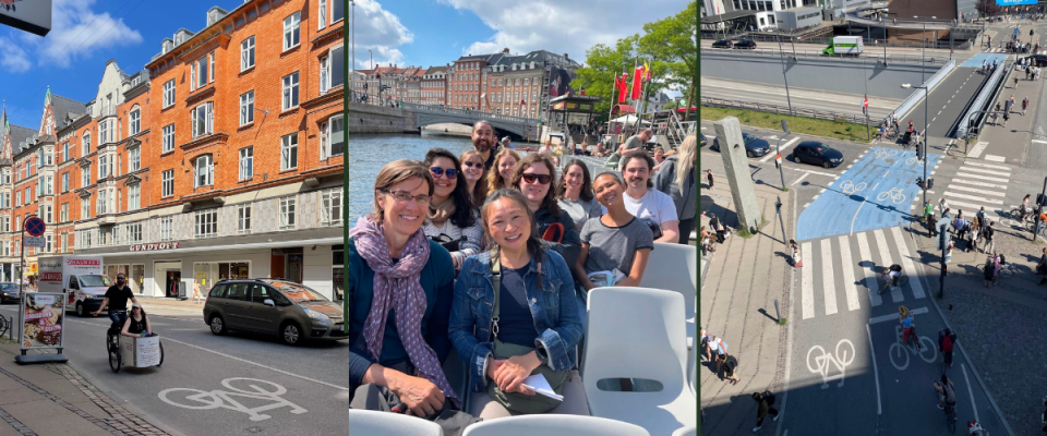
Since 2011, Portland State University and the Initiative for Bicycle and Pedestrian Innovation have offered a unique opportunity to students: a two-week study abroad course that introduces participants to cities with stellar bike cultures. In past years, classes have explored the Netherlands, Sweden, and Denmark. This year’s class of eight students, led by Hau Hagedorn and Drusilla van Hengel, spent two weeks this summer traversing Denmark by public transportation, foot, and (of course) bike. Check out some photos from the trip.

Students came from all over the country—from Portland to Connecticut—to attend the course. What they all had in common was a desire to learn from a city that is renowned to have some of the best bike infrastructure in the world. The students wanted to bring their newfound knowledge back to their respective towns to make the world a safer, happier place for their loved ones and communities.

Ern Tan—the founder of Civic Cincinnati, a grassroots urbanism advocacy group in Ohio—said before the trip that she was looking forward to seeing the promise of a more bikeable future for Cincinnati reflected in...

Read more

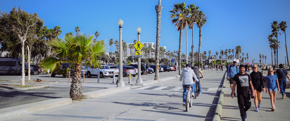
Knowing how many people use walking and bicycling infrastructure is crucial for transportation planning. Active transportation projects can help cities and states achieve multiple climate- and public-health-related targets, and a new project launching in 2024 can help further those goals: California is getting a statewide active transportation count database.

With help from Portland State University (PSU) researcher Sirisha Kothuri, the Safe Transportation Research and Education Center (SafeTREC) at the University of California, Berkeley is leading an effort to create a centralized data repository for the state.

Kothuri, a senior research associate in civil and environmental engineering at PSU, has led multiple research projects aimed at improving the accuracy and scope of nonmotorized data collection efforts. She has experience with using data fusion techniques to estimate bicycle volumes, leveraging crowdsourced data to derive pedestrian counts, and working with this data to make walking and bicycling safer and more comfortable. Her expertise in this area, as well as PSU's experience centralizing transportation data via the university's PORTAL and BikePed Portal, will...

Read more

The need for improving active transportation safety and mobility is clear: Nationally, since 2004, the share of all road user deaths that are pedestrians has risen from just under 11% to nearly 17% in 2020. Cyclists’ share of all fatalities has also increased over the past decade, from 2.1% in 2011 to 2.4% in 2020.. In many cases, solutions are also clear: for example, there are numerous evidence-based approaches to making walking and bicycling safer and more comfortable through improved infrastructure. So if the needs and solutions are clear, why are we not progressing more quickly toward improved road safety and better active transportation options?

In many ways, walking, bicycling, and rolling have not been a top priority for state departments of transportation (DOTs). Changing agency practice is essential: DOTs need research to help them better implement active transportation effectively and seamlessly.

This is the objective of a newly launched project, funded by the National Cooperative Highway Research Program (NCHRP). Over two years, researchers will create an active transportation institutionalization guide to help state DOTs change their culture and processes and integrate active transportation into every stage of their work, from program development and project funding to project delivery, operations and maintenance.

...

Read more

The trip to and from school is made by nearly every child in Oregon every school day. Bike and walk buses, organized groups of school children, parents, and ride/walk leaders, seek to encourage biking and walking to school. A new research project at Portland State University's Transportation Research and Education Center (TREC) will gather information on bike buses nationwide, inspired by the success of Sam Balto's bike bus initiative at Alameda Elementary School in Portland, Oregon.

Balto, a physical education teacher, catapulted into the limelight in 2022 after establishing a weekly bike bus involving over 100 students commuting to school on two wheels. Its success and popularity prompted a broader initiative to understand and promote the benefits of bike and walk buses across the United States.

Researchers John MacArthur and Nathan McNeil, along with Evan Howington, a student in the Master of Urban and...

Read more

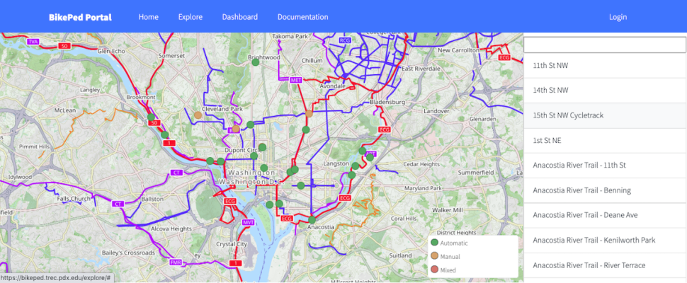
In a big step forward for nonmotorized planning, a dashboard with bike data from the Washington, D.C. metro area is coming to BikePed Portal. Previously, a planner looking to see the latest biking numbers for the nation's capital would have to look at info from several jurisdictions, including Arlington County, the City of Alexandria, the District Department of Transportation, Fairfax County, Montgomery County, and the National Park Service, which manages counters on several trails and natural areas in the greater metro area.

Now, with funding from a National Park Service (NPS) Cooperative Ecosystem Studies Unit (CESU), a unique program that facilitates partnerships between federal and non-federal entities and research institutions, Virginia Tech and the University of North Carolina Highway Safety Research Center (HSRC) are teaming up with data specialists at Portland State University (PSU) to create a new dashboard that will allow users to see all the D.C. bike data together in one place.

Housed at PSU's Transportation Research and Education Center (TREC), BikePed Portal...

Read more

This article is about the 2022 impacts of our IBPI Comprehensive Bikeway Design workshop. See other IBPI trainings, including the faculty workshop "Integrating Bike-Ped Topics Into University Transportation Courses," at our bike/ped training home page.

If you're biking through Cincinnati, Ohio in the next couple of years and find yourself pedaling on a Portland-style neighborhood greenway or two-way protected bike lane, it might be because two engineers from the City of Cincinnati's Department of Transportation & Engineering—Joe Conway and Brian Goubeaux—attended our Comprehensive Bikeway Design Workshop in the summer of 2022 and brought some inspiration home.

The City of Cincinnati is in the process of updating its Bicycle Transportation Plan, adopted in 2010 and due for a refresh. Goubeaux, a senior engineer for the City, said that design strategies and practices he learned during the summer workshop will likely...

Read more

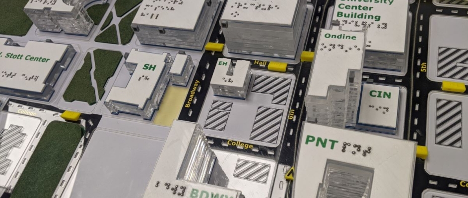
Navigating an unfamiliar place is uniquely challenging for people with disabilities. People with blindness, deafblindness, visual impairment or low vision, as well as those who use wheelchairs, can travel more independently in urban areas with the aid of effective wayfinding technology. A new report from the National Institute for Transportation and Communities (NITC) explores how to leverage low-cost methods to enable people to more easily move through public, urban indoor and outdoor spaces.

The study, led by Martin Swobodzinski and Amy Parker of Portland State University, used focus groups, two case studies, and an in-person structured wayfinding experience on the PSU campus to find the most helpful ways of getting around. Tactile maps were found to be a very useful resource, with an accessible mobile app also showing promise as an orientation and mobility aid.

The researcher will share more details about this project in a free webinar on December 15: Individual Wayfinding in the Context of Visual Impairment, Blindness, and Deafblindness.

WHY IS THIS RESEARCH IMPORTANT?

Environments and...

Read more

Pages