
No archived materials are available for this presentation.
PRESENTATION ARCHIVE
OVERVIEW
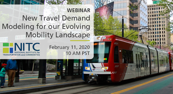
Conventional four-step travel demand models are used by nearly all metropolitan planning organizations (MPOs), state departments of transportation, and local planning agencies, as the basis for long-range transportation planning in the United States. A flaw of the four-step model is its relative insensitivity to the so-called D variables. The D variables are characteristics of the built environment that are known to affect travel behavior. The Ds are development density, land use diversity, street network design, destination accessibility, and distance to transit. In this seminar, we will explain how we developed a vehicle ownership model (car shedding model), an intrazonal travel model (internal capture model), and mode choice model that consider all of the D variables based on household travel surveys and built environmental data for 32, 31, and 29 regions, respectively, validates the models, and demonstrates that the models have far better predictive accuracy than Wasatch Front Regional Council (WFRC)/Mountailand Association of Governments’ (MAG) current models.
In this webinar, researchers Reid Ewing and Sadegh Sabouri will...
Read more
Watch video
View slides
Topic: Understanding Where We Live and How We Travel: The Development of an Online Visual Survey Tool and Pilot Studies Evaluating Preferences in Residential Neighborhood Choice and Commute
Summary: Understanding changing residential preferences—especially as they are represented within land use and travel demand models—is fundamental to understanding the drivers of future housing, land use and transportation policies. As communities struggle to address a rising number of social challenges with increasing economic uncertainty, transportation and land use planning have become increasingly centered on assumptions concerning the market for residential environments and travel choices. In response, an added importance has been placed on the development of toolkits capable of providing a robust and flexible understanding of how differing assumptions contribute to a set of planning scenarios and impact future residential location decisions.
In this presentation, we discuss one such improvement that can be added to the transportation planning toolkit: an innovative visual online survey tool. This tool was developed to provide a means for researchers to communicate the residential environment to the public. Within this study, we test the ability for the...
Read moreThe video begins at 0:52.
Abstract: This seminar concludes the eight week exploration of transportation models and decision tools with a look to the future. Oregon is known for its history of forward thinking policies around sustainable transportation, including linking land use and transportation planning at the regional level, investments in transit and non-motorized modes, and statewide legislation to reduce greenhouse gas emissions. To aid these transportation planning and policy decisions, Oregon has developed some of the most sophisticated models and analytic tools currently in use in the United States. As Oregon moves forward to address the next set of challenges - energy security, climate change, economic constraints and equity, models will need to provide new information at different spatial and temporal scales to support long range planning - 30 to 50 years out - as well as near term decisions - 1 to 5 years ahead. Beth Wemple, a Portland-based consultant with Cambridge Systematics, will share her view on Oregon's transportation future. Keith Lawton, consultant and former transportation planner at Metro, will respond by discussing the next steps for model development and application needed to support this agenda.
Speaker Bio: Keith Lawton is a transport modeling consultant and past Director of Technical services, Metro Planning Department, Portland, OR. He has been active in model...
Read moreNo archived materials are available for this presentation.

The video begins at 0:34.
View slides
Speaker: Joseph Broach, Ph.D. Candidate, Portland State University
Topic: Trick or Treatment? Impact of Route-Level Features on Decisions to Walk or Bike
Summary: Some travel routes attract people walking and cycling, while others may scare them away. What features of street environments are most important, and how do available routes affect decisions to bike or walk on a specific trip?
Research to date has focused on either large-scale areal measures like "miles of bike lane nearby" or else has considered only shortest path routes. Neither method is suited to capturing the impact of targeted route-level policies like neighborhood greenways. This session will present a new technique for measuring bike and walk accessibility along the most likely route for a given trip. The method is applied to travel data, and results provide new insight into the relationship between route quality and travel mode choice.
The video begins at 2:09.
Abstract: The ability to fully understand and accurately characterize freight route choice is one that will support freight modeling frameworks, and regional and state transportation decisions. This ability, when combined with regional and state commodity flow data, can compose an effective statewide freight modeling framework. Typically, transportation network models take a shortest path assumption for truck routing both for strategic and operational routing decisions. The goal of this research was to determining how different subgroups of shippers, carriers, and receivers make route choices, and to understand how these approaches vary across types of routing decisions. We consider route changes of both a spatial and temporal manner. This talk presents the results of a survey of over 800 shippers, carriers, and receivers in Washington State, and recommends a framework for improving the modeling of routing decisions in existing network models.
Speaker Bio: Professor Anne Goodchild has worked and studied in the transportation field for more than 15 years. Her initial experience in management consulting for transportation providers was followed by the completion of a PhD at UC Berkeley and research experience while developing the freight transportation program at the University of Washington. In addition to a BS in mathematics and an MS and PhD in Civil Engineering, Dr....
Read moreAbstract: We study the impact on productivity of a specific operating practice currently adopted by some demand responsive transit (DRT) providers. We investigate the effect of using a zoning vs. a no-zoning strategy on performance measures such as total trip miles, deadhead miles and fleet size. It is difficult to establish closed form expressions to assess the impact on the performance measures of a specific zoning practice for a real transportation network. Thus, we conduct this study through a simulation model of the operations of DRT providers on a network based on data for DRT service in Los Angeles County.
The video begins at 2:26.