
Watch video
PRESENTATION ARCHIVE
OVERVIEW
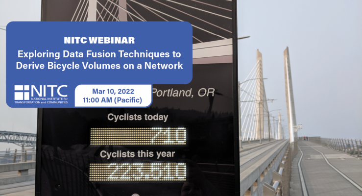
Planners and decision makers have increasingly voiced a need for network-wide estimates of bicycling activity. Such volume estimates have for decades informed motorized planning and analysis but have only recently become feasible for non-motorized travel modes.
Recently, new sources of bicycling activity data have emerged such as Strava, Streetlight, and GPS-enabled bike share systems. These emerging data sources have potential advantages as a complement to traditional count data, and have even been proposed as replacements for such data, since they are collected continuously and for larger portions of local bicycle networks. However, the representativeness of these new data sources has been questioned, and their suitability for producing bicycle volume estimates has yet to...
Read moreBy Jennifer Dill, TREC director.
I recently completed a national poll of people living in urban areas in conjunction with the National Association of Realtors® on Community and Transportation Preferences. The overall results are posted here. The survey included 3,000 adults living in the 50 largest urban areas in the U.S. (That includes suburban areas, as well as denser urban cores.) Here are some highlights related to bicycling.
1. Less than one in five people have biked in the past month.
Overall, 72% of the adults surveyed said they were physically able and know how to ride a bike. Of those, 25% had ridden in the past month. (The survey was conducted in mid-May, so weather was reasonable.) That means only about 18% of adults in these urban areas biked recently. Most of the people who had biked, rode only for exercise (60%, or 15% of those who are able to bike), while the others (40%, or 10% of those who are able to bike) made at least some bike trips for transportation, such as to work, school, shopping, etc.
Note: From here on I will be focusing only on those people who are physically able and know how to ride a bike.
2. There are gender and generational gaps.
This isn’t a big surprise, but women were less likely to bike than men,...
Read more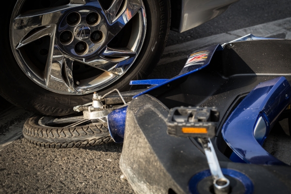
Watch video
View slides
The overall goal of this research was to quantify the safety performance of alternative traffic control strategies to mitigate right-turning-vehicle/bicycle collisions, often called "right-hook" crashes, at signalized intersections in Oregon.
A two stage experiment was developed in the OSU high-fidelity driving simulator to investigate the causal factors of right-hook crashes at signalized intersections with a striped bike lane and no right-turn lane, and to then identify and evaluate alternative design treatments that could mitigate the occurrence of right-hook crashes.
Experiment 1 investigated motorist and environmental related causal factors of right-hook crashes, using three different motorist performance measures:
- visual attention,
- situational awareness (SA) and
- crash avoidance behavior.
Data was collected from 51 participants (30 male and 21 female) turning right 820 times in 21 different experimental scenarios. It was determined that the worst case right-hook scenario occurred when a bicycle was approaching the intersection at a higher speed (16 mph) and positioned in the blind zone of the motorist. In crash and near crash situations (measured by time-to-collision) the most common cause was a...
Read moreThe video begins at 1:37.
View slides
Summary: Signalized intersections often rely on vehicle detection to determine when to give a green light. The 2009 Manual of Uniform Traffic Control Devices (MUTCD) includes an on-pavement marking and curbside sign that public agencies can use to indicate where cyclists should position themselves while waiting at an intersection. This presentation reviews the effectiveness of current markings, signs, and other methods used to help cyclists properly position themselves over detection.
Stefan Bussey is an undergraduate civil engineering student at Portland State University. He is interested in exploring how road users’ interactions with each other and the built environment affect the efficiency and safety of road networks. He currently works as a civil design intern at Harper Houf Peterson Righellis Inc.
The video begins at 2:58.
Abstract: While TriMet and other transit agencies serve many commuters by having racks for bikes on trains and buses, large bike parking facilities in global capitals of urban bicycling provide the key link between bikes and transit. Following the lead of European and Asian cities, the Portland region is starting to develop a network of bike-transit facilities; TriMet is piloting smart bike parking technology in the form of electronic bike lockers and "Bike & Rides". This presentation discusses the background and planning for bike-transit integration in the region and shares insights into bike-transit travel patterns, habits, and market segmentation gained from recent rider surveys.
Learn more about our other research on e-bikes here.
Over the last couple years, electric bicycles (e-bikes) have been gaining momentum. E-bikes may play an important role in addressing cities’ transportation and public health problems by getting more people out of cars and onto bicycles. But as the number of users increase, so too will potential conflicts (actual or perceived) with other road users, causing policy questions to arise.
The current state of e-bikes regulation varies dramatically across state and local jurisdictions, causing confusion. The confusion stems from the wide variety of devices and technologies on the market, perceived overlap of legal entities’ jurisdiction over the device, outdated or absent laws and regulations, and inconsistency of terms used to describe e-bikes. This confusion creates uncertainty for manufacturers and dealers and makes riders wary of embracing e-bikes.
One of the biggest concerns people have about e-bikes and their use, especially on shared-use paths, is speed....
Read more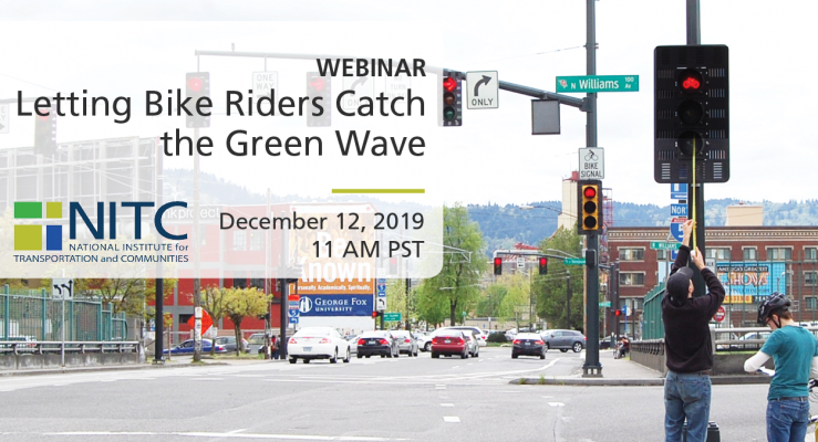
PRESENTATION ARCHIVE
Miss the webinar or want a look back?
OVERVIEW
The "Fast Track" project at the University of Oregon focuses on a mode of transportation that is sometimes left out of vehicle-to-infrastructure, or V2I, conversations: Bicycling. NITC researchers developed an app based on a new technology being integrated into modern cars: GLOSA, or Green Light Optimized Speed Advisory. GLOSA allows motorists to set their speed along corridors to maximize their chances of catching a "green wave" so they won't have to stop at red lights.
This project demonstrates how GLOSA can be used by bicyclists in the same way it is used by motorists, with a test site on a busy car and bike corridor feeding the University of Oregon campus: 13th Avenue in Eugene, Oregon. Researchers developed a smartphone app that tells a cyclist whether they should adjust their speed to stay in tune with the signals and catch the next green. The project demonstrates how university researchers, city traffic engineers, and signal-controller manufacturers can come together to help bicyclists be active participants in a smart transportation...
Read more