Fixing a community’s pedestrian and bicycle infrastructure issues could be as simple as turning on one’s smart phone in the future. At least that’s the hope of OTREC researchers Marc Schlossberg, Ken Kato, Dana Maher, Cody Evers, and Christo Brehm of the University of Oregon.

In the report, Transportation Planning Through Mobile Mapping (Read The Full Report Here), researchers developed and tested the Fix This Tool, a smart phone application that allows community members to assess problems within their transportation environment. The goal was to create a tool that could be affordably distributed to communities across the country so pedestrians and cyclists can actively participate in improving their means of transportation.

As the desire for reduced carbon emissions, reduced congestion, and reduced public spending on transportation infrastructure grows, many state and local governments are looking to encourage walking and bicycling in their communities as an alternative to cars. However, current data on pedestrian and bike networks are limited and there is little understanding on what constitutes appropriate bike and pedestrian infrastructure. To remedy this, local governments must engage residents to find out challenges current users face and what infrastructure is needed to increase biking and walking by residents.

Previous OTREC research developed a tool built on a GIS platform (...

Read more

While the national parks system may have some of the most natural areas in America, there’s nothing natural about how most Americans travel through them: by car.

Todd Johnson, an OTREC graduate research assistant, is hoping to change that for at least one state park. The Eno Transportation Foundation recently chose Johnson for a year-long assignment to find ways to reduce traffic congestion at Arches National Park near Moab, UT.  Every year, Eno puts out five assignments throughout the country to improve transportation at national parks and monuments.

Johnson, a Master of Science student in civil and environmental engineering at Portland State University, previously worked as a transportation interpreter at Rock Mountain National Park, encouraging people to take a shuttle service rather than driving.  He has a similar goal for his stint at Arches.

“We want to get people out of their cars,” Johnson said. “Right now when the parking lots fill up, people park on the side of the road, creating a safety hazard and diminishing the beauty of the park. I will help with implementing solutions to deal with congestion using (Intelligent Transportation Systems) and social media.”

Johnson, an avid cyclist, will also be looking at encouraging alternative forms of transportation through Arches. The park is looking to construct more hiking and biking trails to prevent visitors from driving from one attraction to another, Johnson said. Currently, the park’s roads...

Read more

As a bicycle and pedestrian planning consultant, it bothered Robert Schneider that no one seemed to know exactly what made people choose to walk or bicycle. So he set out to change that.

Now a doctoral candidate from the University of California Berkeley, Schneider will share what he found out during a seminar Friday in Portland.

Working on projects including the Seattle Bicycle Master Plan, Schneider always sought a solid explanation for people’s transportation choices. “There was a great interest in walking and bicycling, and communities were doing more planning for those modes,” he said. “But there was also a big need for more detailed research and an understanding of what motivates people to walk and bicycle.”

Those motivations make up Schneider’s dissertation research. He developed a five-step theory on how people choose travel modes, noting that walking and cycling could be promoted at each step: awareness and availability, basic safety and security, convenience, enjoyment, and habit.

To develop the theory, Schneider surveyed 1,000 people at 20 San Francisco Bay Walgreen’s stores in 2009 and held 26 follow-up interviews the next year. He found an association between shorter travel distances and both walking and cycling. He also found that people who walk or bicycle report...

Read more

In many cases, living in suburbia means relying on an automobile for most trips, even short trips to nearby stores. If housing developments incorporated better paths and sidewalks, however, would anyone use them?

Researcher Nico Larco found that people who live in well-connected developments are significantly more likely to walk and bicycle than those in developments only accessible by automobile. He details his findings in this OTREC report.

Larco, an assistant professor of architecture at the University of Oregon, found that people who live in well-connected developments walked to their nearby commercial strips nearly twice as often as did people in less-connected developments. In addition, a greater percentage of residents in well-connected developments reported sometimes walking or cycling.

Despite suburbia’s reputation for large single-family homes, more than a quarter of suburban housing units are higher density. In fact, the suburbs are home to more than 9 million multifamily housing units, with 5 million more projected for the last 20 years. Although these units tend to be near commercial centers, a lack of pedestrian and bicycle infrastructure makes trips using these modes difficult.

For this research project, Larco developed criteria for measuring connectivity in trips taken from, to and through multifamily suburban developments. Studied developments were rated as “well...

Read more

In a tent in a parking lot under a freeway bridge, Ray LaHood saw the future of the country’s transportation network Tuesday. The U.S. Secretary of Transportation spoke to reporters, dignitaries and construction workers in the muddy work zone of Southwest Moody Avenue.

Last year, the project to rebuild Moody Avenue received a $23.2 million grant from the federal stimulus package. The project will double the streetcar tracks and add a cycle track and sidewalks. It will also ease connections to a new transit bridge that will carry the Portland-Milwaukie light rail line, the eastside streetcar loop, cyclists and pedestrians.

LaHood, joined by the area's congressional delegation, city and state officials, stressed the jobs the project is creating and the boost for the mix of transportation modes it represents. The project will also reduce congestion, LaHood said, by making transit attractive to current and future residents and employees.

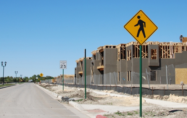
Before construction started along Moody, automobile congestion was virtually nonexistent. However, it’s a heavily trafficked bicycle route connecting Portland’s cycle-friendly downtown bridges with its largest employer, Oregon Health and Science University.

By allowing choices of light-rail train, streetcar, bicycle and shoe leather, the project stands to boost those forms of transportation. If commuters leave their cars at home, that represents a reduction in congestion elsewhere. Of course, the project will also add...

Read more

Thursday, Jan. 27 dispatch from the TRB annual meeting in Washington, D.C.:

Not everyone who attends the Transportation Research Board’s annual meeting in Washington, D.C., stays until the end. This year, many who planned to leave before Thurday’s sessions just couldn’t pull themselves away.

Thank the snowstorm.

With fresh snow quickly coating the capital region, flights were canceled and delayed while other traffic came to a standstill. Even the annual meeting’s internal transportation system ground to a halt, as shuttle buses between the three conference hotels stopped running. The Capital Bikeshare program that had served attendees so well on a tour of the district earlier in the week shut down for the weather.

Conference attendees got their exercise walking between hotels, and stopping for snowball fights along the way. Others, with an unplanned night in town, gave more business to District bars.

Along the way, a conference dedicated to the multitude of transportation modes ended up highlighting the original: walking. “Turns out I actually walked 6.3 miles (or more) yesterday,” Richard Moeur, a Phoenix-based traffic engineer, wrote on Twitter. “Need snowshoes!”

Jennifer Dill, OTREC’s director, said the streets in the District’s core were clear by Thursdsay, although the scene Wednesday night was chaotic. “The snow does shut down Washington,” Dill said. “Buses were getting stuck going uphill. There was a big line for taxis.”

...

Read more

Think people who live in suburban developments don't walk and bike? They do, particularly if the development is well-connected. University of Oregon assistant professor Nico Larco has shown this with his OTREC projects.

He explains some of the work himself in this video.

This OTREC educational project took students at Portland State University beyond the lecture hall and the library. Dr. Lynn Weigand expanded the bicycle and pedestrian design curriculum at PSU by turning an existing three-credit course into a five-credit course with an applied lab. The new course gave students the opportunity to apply the knowledge they gained in class to real projects in their community. Working in teams, the students developed projects that focused on improving bicycle and pedestrian connections to the PSU campus. The course received excellent reviews from the students, and the department recognized the courseís value by offering it again the following year. The report can be downloaded at: https://ppms.trec.pdx.edu/media/project_files/OTREC-ED-10-01.pdf.

Professor John Pucher, a car-less commuter from the Bloustein School of Planning and Public Policy at Rutgers University, was the first fall OTREC Visiting Scholar and CTS Seminar guest on September 28, 2007. His presentation, "Promoting Safe Walking and Cycling to Improve Public Health: Lessons from Europe," was standing room only, and the audience enjoyed his photos of bike-friendly features in cities across Europe. Pucher examined a range of public health impacts of our urban transport systems and argued that the current car dependence of American cities is responsible for enormous environmental harm, social isolation, lack of physical activity, and traffic dangers. He described how improving the convenience, safety, and attractiveness of walking and cycling in crucial to overcoming these negative impacts. Pucher discussed specific policies and programs used in Europe, and advocates their widespread adoption in American cities. A lively discussion with faculty, students and members of the Portland Bicycle Master Plan Committee followed the seminar.

Watch video

View slides

Summary: Researchers from the transportation, planning and health fields share the common goal of promoting physically active lifestyle. One challenge that researchers often face is the measurement of physical activity, particularly among children. This is because the sporadic nature of children’s physical activity patterns makes it difficult to recall and quantify such activities. Additionally, children’s lower cognitive functioning compared to adults prevents them from accurately recalling their activities. This presentation will describe the design and application of a novel self-report instrument - the Graphs for Recalling Activity Time (GReAT) - for measuring children’s activity time use patterns. The instrument was applied in a study of children’s risk for obesity and diabetes in a predominately Hispanic community in Milwaukee, WI. Time-use data for two weekdays and one weekend day were collected for various physical and sedentary activities. The data was then assessed against measurements of the children’s cardiovascular fitness, weight status and insulin resistance through exploratory analysis and structured equation modeling. Findings on GReAT’s reliability and new evidence on the impacts of time-use in different activities on children’s risk for...

Read more

Pages