
The video begins at 3:10.
Watch video
View slides
Summary: The Federal Transit Administration invests in building the capacity and improving the quality of public transportation throughout the United States of America. Under FTA's leadership, public rail, bus, trolley, ferry, and other transit services have reached greater levels of safety, reliability, availability, and accessibility. Come hear the highlights of FTA's impacts and participate in an interactive question/answer session and discussion on career options in public transportation!
Bio: Amy Changchien is the Director of Planning & Program Development of the Federal Transit Administration Region 10 Office in Seattle. Ms. Changchien has been a transportation professional for over 20 years, with experience spanning from highway to transit. In her career, she has worked on projects involving highway operations, Intelligent Transportation System, commuter rail, light rail, streetcar, ferries, and buses. Ms. Changchien holds a bachelor's degree in Civil Engineering and a master's degree in Public Administration from University of Washington.
View slides
Abstract: Our speaker for May 14, 2010 is Gill V. Hicks, Director Southern California Operations for Cambridge Systematics, Inc. For more than ten years, Mr. Hicks served as the General Manager of the Alameda Corridor Transportation Authority (ACTA). The $2.4 billion Alameda Corridor consolidated harbor-related railroad traffic onto a single 20-mile corridor between the ports of Los Angeles and Long Beach and the railroad mainlines near downtown Los Angeles. Mr. Hicks’ responsibilities included overall management of the agency, building consensus, estimating benefits and costs of the project, generating political support, testifying before U.S. Congress, State Legislature, regulatory bodies, city councils, funding agencies and other stakeholders; developing a financial plan, raising funds, coordinating with railroad, trucking, and shipping businesses, and managing contracts for the project.
Mr. Hicks will discuss the major challenges faced by the project, including negotiations with three competing railroads, several municipal governments, utilities, regulatory agencies, contractors, and funding entities. The process for consensus building will be discussed. Major lessons learned will be described, including methods for reducing project risk, keeping on schedule and within budget. Mr. Hicks will also touch on the challenges facing the agency as...
Read moreView slides
If you would like to receive continuing education credits such as PDH or CM, please make sure to complete this evaluation form once you've watched the entire video so that we have a record of your attendance.
Watch video:
Read more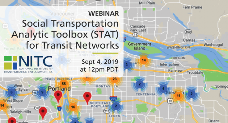
PRESENTATION ARCHIVE
Miss the webinar or want a look back?
OVERVIEW
This webinar will present an open-source socio-transportation analytic toolbox (STAT) for public transit system planning. This webinar will consist of a demonstration of the STAT toolbox, for the primary purpose of getting feedback from transit agencies on the tool's usefulness. We are especially interested in hearing about any improvements that would aid transit agencies in implementing it.
The STAT toolbox was created in an effort to integrate social media and general transit feed specification (GTFS) data for transit agencies, to aid in evaluating and enhancing the performance of public transit systems. The toolbox enables the integration, analysis, and visualization of two major new open transportation data sources—social media and GTFS data—to support transit decision making. In this webinar, we will introduce how we...
Read moreThe video begins at 2:16.
Abstract: Reliance on the automobile for most trips contributes to costly trends like pollution, oil dependence, congestion, and obesity. Germany and the U.S. have among the highest motorization rates in the world. Yet Germans make a four times higher share of trips by foot, bike, and public transport and drive for a 25 percent lower share of trips.
This presentation first investigates international trends in daily travel behavior with a focus on Germany and the USA. Next, the presentation examines the transport and land-use policies in Germany over the last 40 years that have encouraged more walking, bicycling, and public transport use. Using a case study of policy changes in the German city of Freiburg, the presentation concludes with policies that are transferable to car-oriented countries around the world.
Bio: Ralph Buehler is Assistant Professor of Urban Affairs & Planning and a Faculty Fellow with the Metropolitan Institute at Virginia Tech in Alexandria, VA. Originally from Germany, most of his research has an international comparative perspective, contrasting transport and land-use policies, transport systems, and travel behavior in Western Europe and North America. His research falls into three areas: (1) the influence of transport policy, land use, socio- demographics on travel behavior; (2) bicycling, walking, and public health; and (3) public transport...
Read more