Chris Monsere, Sirisha Kothuri and Jason Anderson of Portland State University developed guidance for the Oregon Department of Transportation (ODOT) regarding the placement of Rectangular Rapid Flash Beacons, or RRFB's, in combination with median refuges on three-lane roadways. Their research explored the effect of these crossings on driver yielding behavior. For roads with volumes higher than 12,000 average daily traffic (ADT), they found high yielding rates at pedestrian crossings that had a beacon, whether or not there was a median. This demonstrates that the RRFB is a useful tool for alerting drivers to the presence of pedestrians at crosswalks. The researchers also found that for roadways with less than 12,000 ADT, the addition of a median refuge increases driver yielding. 

Read the final report.

Researchers
monsere@pdx.edu
jason.c.anderson@pdx.edu
skothuri@pdx.edu

Tags

The Impacts of the Bicycle Network on Bicycling Activity: A Longitudinal Multi-City Approach

Wei Shi, Portland State University

In active transportation research, plenty of attention has been given to how different types of bike infrastructure affect people's likelihood of biking. Research has demonstrated that protected bike lanes encourage more people to bike than simple painted lanes, and that most cyclists feel safer riding through a protected intersection as opposed to navigating shared space with cars. However, relatively few empirical studies have investigated how holistically connected an entire bike network is, and how different populations can be positively or negatively impacted in their decision to bike by that level of connectivity.

Wei Shi, a recent Portland State University graduate with a PhD in urban planning, wrote her doctoral thesis on "The Impacts of the Bicycle Network on Bicycling Activity: a Longitudinal Multi-City Approach." In her work she found that a well-connected bicycle network - not individual bike lane segments or intersections, but the overall connection between places - is a big factor in people’s decision to bike. This is especially true for disadvantaged populations, including females and low income families.

HOW DID THE RESEARCH DETERMINE THIS?

Theoretically, a complete bicycle network is more than the sum of its parts. Its total impact on cycling is expected to be greater than the combined impacts of each segment. Working with her PSU faculty advisor, Jenny Liu, Shi started by identifying metrics to measure the connectivity of a network. Her dissertation includes a comprehensive literature review considering all the ways researchers have proposed to measure bicycle networks. For her study, Shi ultimately chose a method developed by Peter Furth of Northeastern University. Furth's model for measuring the connectivity of low-stress bicycle networks offers a classification of different types of street connections by their stress level, from 1 (suitable for children) to 4 (only 2-3% of cyclists willing to ride). In the final report, pages 25–31 and 47–53 illustrate the detailed bicycle network metrics Shi designed for the study.

Next, Shi used publicly available OpenStreetMap (OSM) data to measure the bicycle networks in two cities – Portland and Minneapolis. Why those cities? There was plentiful and relatively high quality bike count data available for both. The completeness of OSM data has been increasing each year, and future researchers can benefit from the successful demonstration of this methodology.

For both cities, Shi used bike count data to measure cycling activity, and open-source data plus additional supplementary data to measure three major types of bicycle infrastructure: on-street bike lanes, bike boulevards, and off-street paths. Using Furth's criteria she measured distance, stress along the route, and in general how easy it was to travel from one point to another along the bike network. Once she had evaluated a network for its connectivity and ease of use, she looked at the bike count data to see that network's impact on, and relationship to, bike ridership.

FINDINGS FROM PORTLAND AND MINNEAPOLIS

Both cities showed an improvement in level of traffic stress (LTS) between 2011 and 2017. In Portland, the major changes occurred in the far east Portland, northeast, and southern downtown areas of the city. These were the areas with significant infrastructure investments during the six years. These included the opening of the car-free Tilikum Crossing bridge, and bike boulevard construction in the southeast areas. The percentage of high-stress street segments decreased from 45% to 43%.

The City of Minneapolis also invested in new bicycle infrastructure during the past decade. The major changes happened in the downtown area. For example, protected bike lanes were constructed along two river-crossing roads: Central Avenue and 10th Avenue SE, around the University of Minnesota. In addition, bike lanes were installed across the city on arterials and major streets such as Central Avenue North and Lyndale Avenue North. The percentage of high-stress street segments decreased from 18.4% to 15.9% between 2011 and 2017.

The study found that the low stress bicycle network was associated with high bicycle ridership and high probability of choosing bikes among other travel modes, after controlling for other variables. In particular, the low-stress catchment area significantly affected bike counts in both case cities, indicating the importance of the extensiveness of the bicycle network in promoting bicycling activity. Increasing the reachable area via a low-stress-only network from a bike counter location by 1 square mile was associated with a 10% increase in bicycle volume in Portland, and a 14% increase in Minneapolis.

THE CONNECTION BETWEEN SOCIAL EQUITY AND BICYCLE NETWORKS

To determine if a well-connected bicycle network would especially benefit disadvantaged populations, Shi used one year of travel survey data in Portland from the Oregon Household Activity Survey (OHAS). She separated the data by gender, and found that the bicycle network influenced the female group more significantly. By increasing one unit of the low stress level metric along the travel route, the relative probability of choosing cycling than other modes was 26% higher for females. However, the same change in travel route didn't have significant impacts for males on choosing cycling compared to other modes. In other words, a connected network encourages women to bike more frequently.

In addition to gender, Shi also explored income level. She divided the population by income and found that the low-income population cares more about whether the bicycle network is holistic or not. In particular, increasing one unit of the low stress level metric along travel routes was associated with a 76% higher relative probability of choosing cycling compared to other modes for the low-income group, while the impacts on high-income counterparts were not significant. In other words, a better-connected network would make low-income travelers more likely to choose biking, while for high-income residents, this trend does not exist. It’s important to note that not having safe bike lanes to ride in leads to more frequent dangerous interactions between cyclists and motorists, and that has led to more confrontations with police. The holistic connectivity of that bike route takes on new significance when we consider barriers to biking. (Watch a recent PSU Friday Transportation Seminar: Biking While Black.)

IMPACTS ON FUTURE RESEARCH

In addition to demonstrating a successful methodology that future researchers can build upon, Shi's work also highlights the importance of accurate and open access data. 

"Having these data readily accessible for researchers and planners is essential. For cities that don't have these data, how can they even begin to measure the success of their investments in bikeway networks?" Shi said.

A lot of current research is focused on finding associations between ridership and network quality. In this dissertation, Shi was hoping to find some causal inference there: proof that the correlation between ridership and network quality is a cause-and-effect relationship. While this study did not prove that bike networks are the cause of increased ridership, she would like to see whether additional data, or another analytical approach, can further explore that point in the future.

IMPACTS ON PRACTICE AND POLICY

One of Shi's aims in conducting the study was to provide transportation professionals with concrete evidence that if they pay attention to connecting bicycle facilities, they can anticipate an increase in ridership. In particular, the improvements in bicycle networks would disproportionately benefit disadvantaged populations, such as female and low-income groups, by increasing their probability of riding bikes. If the goal is to achieve a certain mode share or certain active transportation goals, especially targeting disadvantaged population groups, this is some concrete evidence that connected networks can support that.

RELATED RESEARCH

To learn more about this and other Portland State University transportation research, sign up for our monthly research newsletter.

The Transportation Research and Education Center (TREC) at Portland State University is home to the National Institute for Transportation and Communities (NITC), the Initiative for Bicycle and Pedestrian Innovation (IBPI), and other transportation programs. TREC produces research and tools for transportation decision makers, develops K-12 curriculum to expand the diversity and capacity of the workforce, and engages students and professionals through education.

Researchers
shiwei@pdx.edu

A review of equity and vehicle sharing, by Jennifer Dill and Nathan McNeil of PSU, appears this month in a special issue of the Journal of Planning Literature (click here for access to a free author's edition). They investigated whether shared vehicle systems – carsharing, bikesharing, and e-scooter sharing – are equitable. Overall, they did not find much evidence that they are improving accessibility for disadvantaged populations. Equity programs in carsharing are notably understudied. Given that many cities lack safe bicycle infrastructure and trip distances can be long, there may be more immediate potential for improving accessibility through carsharing. The benefits of access to a vehicle for low income people are well documented.

Read Dr. Dill's blog here.

Photo by Cait McCusker

Comparing the Promise and Reality of E-Scooters: A Critical Assessment of Equity Improvements and Mode-Shift

Michael McQueen, Portland State University

Is shared micromobility the ideal first/last mile supplement to transit? Can electric scooters make it easier for historically disadvantaged populations to get around? In just three years, brand-new fleets of e-scooters have substantially disrupted and altered the urban mobility landscape. For proponents, it's tempting to view them as a new answer to old problems. A just-released study finds however, that while there is potential for improved mobility if they are paired with other interventions, the shiny rows of e-scooters parked around cities aren't a catchall solution for our longstanding issues.

Portland State University (PSU) graduate Michael McQueen surveyed nearly 2,000 PSU students in his masters thesis, "Comparing the Promise and Reality of E-Scooters: A Critical Assessment of Equity Improvements and Mode-Shift," to learn about their travel behaviors, preferences and barriers to using e-scooters. 

WHAT DOES A UNIVERSITY CAMPUS REVEAL ABOUT E-SCOOTER USAGE IN THE CITY?

PSU students offer an easily-accessible large population with the shared experience of frequently traveling to a specific urban location–the PSU campus in downtown Portland. The survey sample closely represented the university’s full student population by racial makeup. The sample was more racially diverse than the Portland metro area and it captured twice as many female respondents as male respondents, which resulted in models that contained smaller margins of error for racial minority and female coefficients. This is critical to understanding the equity impacts. Given the university setting, it was largely skewed towards younger and lower-income respondents. The upside is that this demographic is typically considered more progressive in their transportation choices, which renders McQueen’s findings about their use and perceptions of non-car modes as conservative when compared to the Portland metro area as a whole. 

Students were asked how they currently use and perceive e-scooters, and which mode they would choose (between a car, bike, or e-scooter + light rail combination) to get to PSU in a stated choice experiment. Respondents chose their preferred mode in several hypothetical scenarios where the travel times and costs varied. McQueen then developed a model from the experiment which controlled for travel time, cost, sociodemographics, health, travel behavior, and latent attitudes towards the travel modes. 

PRIMARY FINDINGS: WHAT INFLUENCES MODE CHOICE?

The statistical model revealed that e-scooters in combination with MAX light rail were not regarded as the most preferred mode for getting to campus anywhere in the metro region, given current pricing and travel times. McQueen concluded that cities should not depend on e-scooters as a de facto first-mile/last-mile solution without targeted management interventions. 

So which factors influenced mode choice for traveling to PSU? Some findings that stood out:

  • Car "friction" (increased drive time and parking cost) positively influenced choosing e-scooter + MAX (Portland's light rail transit system).

  • E-scooter and MAX "friction" (increased walk time to e-scooter, e-scooter ride time, e-scooter cost, and MAX ride time) negatively influenced choosing e-scooter + MAX.

  • Black respondents were 45% less likely to choose e-scooter + MAX compared to white respondents.

  • Female respondents were 27% less likely to choose e-scooter + MAX compared to male respondents.

  • More entrenched drivers were less likely to choose e-scooter + MAX (both those who took more car trips and those who felt more positively about cars).

  • Those who already perceived bikes, e-scooters and MAX more positively were more likely to choose e-scooter + MAX.

McQueen applied the model spatially to Portland, to understand catchment areas where the average respondent would prefer which mode given realistic travel times and prices. The below maps illustrate the catchment areas. In these maps, the color indicates the most likely mode choice at that location, and the intensity of the color indicates the probability that it would be chosen among the three modes. 

Test: Current Conditions

Currently, there is no place in the metro area where using e-scooter + MAX is the most preferable mode choice, on average (note there is no yellow): 

Test: Free E-Scooters

Making e-scooters free does not make e-scooters + MAX preferable anywhere new (note there is still no yellow): 

Test: Several Targeted Management Interventions

Combining several interventions (in this example: increased parking cost, free e-scooter rides, and PR for MAX and e-scooters) could have the desired effect of encouraging more students to choose e-scooter + light rail transit to get to campus. Note this approach results in e-scooter + MAX being the preferred choice in a large area (lots of yellow):

BARRIERS TO RIDING E-SCOOTERS

At the time of the survey (the week of Mar 2, 2020), only 6% of the nearly 2,000 respondents had taken at least one e-scooter ride in the previous 7 days. They were asked about barriers that prevented them from riding e-scooters more frequently: 

  • 52% have never tried riding an e-scooter before 

  • 49% don't feel comfortable riding in traffic 

  • 45% don't want to ride when the weather is bad 

  • 39% can't count on an e-scooter being around when they need it 

  • 35% can't afford to ride an e-scooter regularly 

  • 21% not enough dedicated lanes

A significantly larger portion of women than men cited e-scooter inexperience, discomfort riding in traffic, and bad weather as barriers. The model did not reveal any significant difference among race/ethnicities for citing these barriers. 

WHERE DO WE GO FROM HERE?

The results of this research can offer the following general guidance for practitioners: 

  • Transportation professionals should not depend on e-scooters to be used as a first-mile/last-mile solution without targeted management interventions. 

  • One possible solution is to limit e-scooter service exclusively to the suburbs, as these are the first areas where e-scooter + MAX begins to become the most preferable mode once parking cost increases. 

  • We need to rethink how we encourage equity in transportation, as e-scooters do not inherently bring about greater racial or gender equity. 

  • Consider that policies that help make e-scooters + MAX more preferable also encourage more bike use (increased parking cost, for example).

MORE ABOUT THE RESEARCHER 

Michael McQueen graduated from PSU in summer 2020 with a masters of civil and environmental engineering degree. During the course of his masters program he has been selected as a YPT Streetlight Fellow, a two-time Eisenhower Fellow, and a National Institute for Transportation and Communities (NITC) Scholar. He has served as a graduate research assistant on several TREC research projects, including a set of white papers about e-bike potential, an exploration of e-bike travel behavior, a project on "Vehicle Miles Traveled (VMT) Methodology of Benchmarking Transportation System Performance" for the City of Portland, and a study on trip generation at multifamily housing

Mike was instrumental in the development of an innovative electric vehicle cost and impact tool, launched in June 2020. He was lead author on the October 2020 paper "The E-Bike Potential: Estimating regional e-bike impacts on greenhouse gas emissions," published in Transportation Research Part D: Transport and Environment. He also contributed to "Transportation Transformation: Is Micromobility Making a Macro Impact on Sustainability?", a literature review led by PSU's Kelly Clifton that has just been accepted to the Journal of Planning Literature. To hear directly from Mike about his research on how e-bike incentives could expand the market, watch a video interview with him, recorded during the 2019 Transportation & Communities Summit.

RELATED RESEARCH

To learn more about this and other TREC research, sign up for our monthly research newsletter.

The Transportation Research and Education Center (TREC) at Portland State University is home to the National Institute for Transportation and Communities (NITC), the Initiative for Bicycle and Pedestrian Innovation (IBPI), and other transportation programs. TREC produces research and tools for transportation decision makers, develops K-12 curriculum to expand the diversity and capacity of the workforce, and engages students and professionals through education.

We're proud to announce that our associate director, Hau Hagedorn, has been named the new Chair of Oregon's governor-appointed Bicycle and Pedestrian Advisory Committee.

OBPAC serves as a liaison between the public and the Oregon Department of Transportation. The eight-member committee advises ODOT in the regulation of bicycle and pedestrian traffic, the establishment of bikeways and walkways, and other statewide bicycle and pedestrian issues.

The committee meets six times a year in various locations around the state to support implementation of the Oregon Bicycle and Pedestrian Plan and listen to the views and concerns of interested citizens, local officials and ODOT staff.

The Transportation Research and Education Center (TREC) at Portland State University is home to the National Institute for Transportation and Communities (NITC), the Initiative for Bicycle and Pedestrian Innovation (IBPI), and other transportation programs. TREC produces research and tools for transportation decision makers, develops K-12 curriculum to expand the diversity and capacity of the workforce, and engages students and professionals through education.

Photo by Cait McCusker

In our previous posts about Portland, Oregon bike travel and the pandemic from April and May, we observed bridge crossing stagnation and decline across the Hawthorne and Tilikum Crossing bridges during normal commute hours. To expand on these findings, we took a look at how Portland’s bike share system – BIKETOWN – has been impacted by the global pandemic.

Claims of a worldwide boom in bike share usage were reported during the early days of COVID-related closures. However, a few months have gone by and it’s now apparent that these findings were misleading due to limited sample selection. For example, some of the reported US bike share ridership outlooks were based on data collected over a very short period, just a week and a half in early March for Chicago and NYC. In the same article, Seattle and San Francisco were actually shown to have experienced a decrease in bike share ridership. In contrast, the Federal Bureau of Transportation Statistics (BTS), using data from March, April, and May, has actually found between a 7% and 60% overall decrease in bike share ridership across several US cities compared to 2019 levels. But what about Portland?

Unfortunately, Portland’s bike share system has not fared much differently from the rest of the country, when compared to the BTS report. Controlling for seasonal ridership trends, we fit a regression curve (R2 = 0.63, which means it accounts for 63% of the variation in the data) to all of BIKETOWN’s pre-COVID trip data, and compared it with the post-COVID closure data we have through the end of August, 2020 (Fig. 1). (Data anomaly: The spike in trips observed mid-2018 were a result of all rides being free during the May Bike to Work Challenge.)

Fig 1.: Daily observed trips since the start of BIKETOWN. Blue curve: seasonally adjusted predicted daily trips. Solid orange: schools closed (Mar 12, 2020). Dashed orange: stay-at-home order issued (Mar 23, 2020)

Looking closer at 2020 (Fig 2.):

Fig 2.: Daily observed trips, 2020 only. Blue curve: seasonally adjusted predicted daily trips. Solid orange: schools closed (Mar 12, 2020). Dashed orange: stay-at-home order issued (Mar 23, 2020)

We found that so far during the pandemic, on average, BIKETOWN ridership is down 72.7% (standard deviation 8.7%) compared to the expected ridership for that day of the year according to our model.

We were also curious to understand how this manifests spatially using rough trip origin and destination coordinates provided by BIKETOWN. We followed a similar method to An et al. (2019) for building the flow maps presented below. These maps show Portland split into census tracts, areas defined by the Census Bureau that contain similar numbers of residents. We arrange the maps to show average trip origins and destinations between and within census tracts, for three-hour intervals for dates before and after the implementation of COVID restrictions. The total average trips per day during the time period is also displayed on each map. First, looking at weekdays (Fig 3 & 4):

Fig 3. Flow maps depicting trip origins and destinations between and within census tracts for the average weekday morning, pre- and post-COVID closures.

Fig 4. Flow maps depicting trip origins and destinations between and within census tracts for the average weekday afternoon, pre- and post-COVID closures.

We notice an unmistakable drop in total trips at all hours of the day - in particular, we see a reduction in trips to and from downtown and between other census tracts during normal commute and happy hours. There is a lesser drop in trips remaining within the downtown census tracts, except during the noon to 3 PM period. Yet, the number of trips that remain within census tracts outside of downtown is similar to pre-COVID times. This tells us that riders are maintaining a similar number of trips to local destinations while reducing the number of longer-distance inter-census tract trips.

Next, let’s look at weekends (Fig 5 & 6):

Fig 5. Flow maps depicting trip origins and destinations between and within census tracts for the average weekend day morning, pre- and post-COVID closures.

Fig 6. Flow maps depicting trip origins and destinations between and within census tracts for the average weekend day evening, pre- and post-COVID closures.

Similar to weekday trips, weekend trips are also down at all hours of the day. This manifests most prominently in inter-census tract and downtown trips. Again, intra-census tract trip levels remain similar to pre-COVID times, except early in the morning and late in the evening.

Interestingly, there appear to be more trips occuring in a few new north and east census tracts compared to pre-COVID times, but this could be showing up due to added system area coverage since the initial launch of BIKETOWN. (Read more about BIKETOWN’s system area expansions in their blog posts from June 1, 2017 and May 31, 2018.) Since these areas were not originally part of the system for several years, the census tracts around the edges of the current system area have artificially lower pre-COVID average trips.

To better contextualize these results, we hope to compare Portland’s bike share trends with those in other cities soon. Additionally, it will be interesting to track how BIKETOWN ridership behavior changes as the new electrified fleet rolls out this month. Stay tuned!

LEARN MORE about Portland State University research on bike share and e-bikes.

ABOUT THE AUTHORS


Michael McQueen

Graduate Research Assistant

Mike McQueen is a second year master's student working with John MacArthur of TREC and Kelly Clifton of the Department of Civil and Environmental Engineering. Currently Mike is researching e-bike travel behavior and micromobility as an Eisenhower Fellow. In the past he has studied e-bike purchase incentive programs, potential positive environmental impact of e-bikes in Portland, BIKETOWN, and the demographics of zero car households.

 
Tammy Lee, Ph.D.

Transportation Data Program Administrator

Tammy is working on a variety of projects for TREC, including documentation, data synthesis, analysis, and visualization supporting ongoing work with PORTAL and Bike-Ped Portal. Prior to joining TREC, she worked as a data scientist for a political digital media consulting firm.


The Transportation Research and Education Center (TREC) at Portland State University is home to the National Institute for Transportation and Communities (NITC), the Initiative for Bicycle and Pedestrian Innovation (IBPI), and other transportation programs. TREC produces research and tools for transportation decision makers, develops K-12 curriculum to expand the diversity and capacity of the workforce, and engages students and professionals through education. For resources and tools for remote teaching during the quarantine period, check out our TREC and COVID-19 resource page.

On March 23, 2020, Oregon — like many other U.S. states — was placed under a stay-at-home order to prevent the spread of COVID-19. At Portland State, we were faced with a decision: What to do about our 2020 transportation summer camps for Oregon high schoolers

Our camps, up to this year, have been defined by the in-person, on-campus experience. Previous cohorts toured Portland's bikeways, saw the inside of Multnomah County's bridges, and sat down with professional engineers and planners to talk about tricky traffic problems. Would the program survive the transition to a virtual format?

We had already received 52 applications from promising Oregon high schoolers, and decided the camp was too important to cancel. With the financial support of the Oregon Department of Transportation and the Federal Highway Administration, we were able to shift to a virtual camp and still fulfill our objectives:

  • Introduce high school students to professionals in transportation 

  • Teach them about the broad range of transportation careers and sectors 

  • Present the social justice and equity issues within transportation and how they relate to students, their families and their neighborhoods 

  • Introduce students to transportation systems in Portland 

  • Connect them with other high school students who are passionate about careers in STEM 

  • Have fun!

Of the 52 original applicants for the residential camp, 27 students signed up for the virtual experience. There were 12 campers in the girls' camp and 15 in the all-genders camp.

When surveyed after the camps, all the respondents indicated a fairly high level of interest (at least 3 or higher, on a 1-5 scale) in pursuing a career in transportation.

GOING VIRTUAL WITH TRANSPORTATION

Our transportation education program coordinator, Nora Stoelting, events administrator Theresa Somrak, and Associate Director Hau Hagedorn had just a few weeks to work with instructors and shift to an online curriculum. With four years of transportation camps under our belt, we had plenty of material to draw from. Our staff dove in with genuine enthusiasm and creative solutions. 

We switched up the camps to partial days over four weeks. In between online sessions there were weekly field exercises where students (masked for safety, and wearing reflective vests we provided) had to go out and collect data in their own neighborhoods. Despite the uncertainty going into it, the 2020 virtual camps turned out better than we could have imagined. Here are a few quotes from the students:

 "I was sad when I learned that it would be online, and I would have loved meeting everybody in real life. But it was actually so much fun, and it was formatted in a way where there was enough time to complete the projects at home and also stay engaged for those four weeks."

"After learning from the presenters, it made me begin to consider a job as a traffic engineer or as a planner of school routes. Transportation is a very special field because it has a big impact on people's daily lives and I feel that people sometimes take that for granted." 

"All of the speakers were amazing and I learned new things from each one. I really loved the speaker who talked about tactical urbanism because it was inspiring and felt like something that I could realistically do."

CREATING AN INTENTIONAL SPACE FOR CONNECTION: PEER MENTORS

Seeking to enhance the virtual experience, we hired peer mentors from Oregon colleges and universities: young adults who could give direction and guidance to the camp attendees. We found five outstanding mentors who worked with students (here are some of their blogs from the first camp) and really made the difference in terms of facilitating small group discussions: Aujai Webster, Desly Amurao, Dayana Camaal Perez, Noah Kulala, and Noah Kurzenhauser

"Transportation is an inherently multi-dimensional and protean field; it seems that new ideas are constantly arising, and individuals are beginning to draw connections to other societal factors (most prominently race and socioeconomic status).  Serving as a peer mentor in TREC's 2020 virtual summer camp afforded me the opportunity to assist in disseminating this information and sundry learning opportunities to the bright and enthusiastic youth that participated.  It was reassuring and calming, especially in today's volatile climate, to see that the upcoming generation is in good hands." - Noah Kurzenhauser, 2020 Peer Mentor

 "My relationship with my mentor was great. It was very nice having her check in on me each week and remind me of what was going on weekly. Having a mentor added positively to my overall camp experience." - 2020 Camp Participant

CENTERING RACIAL EQUITY IN THE CURRICULUM

The intersection of transportation and social equity has always been a major focus of our summer camps. Social equity is a broad umbrella term, but this year, in the midst of global protests against police brutality after the killings of George Floyd, Breonna Taylor and other unarmed black people by law enforcement officers, we zeroed in on how transportation intersects with racial equity. 

To this end, we reframed our curriculum to broaden students' understanding of racial equity as a core aspect of planning and engineering. In the history of the transportation field, harm has been caused through gentrification and neighborhood displacement, over-policing of BIPOC communities, a lack of mobility options for many transit-dependent populations, and a fear of harassment on the streets and on public transit. We stressed how the future of the profession must put equity front and center in order to mitigate harmful impacts of past policies, and prevent future harms.

TRANSPORTATION PROFESSIONALS FROM THE PORTLAND METRO AREA

We also want to share our gratitude for the community of transportation professionals without whose support and involvement the camps could not have been held. Twenty-four professionals from public and private agencies joined us for a "speed networking" event with the students, fielding career questions and learning about students' interests. Seven instructors gave guest lectures or led workshops: Gwen Shaw of Toole Design; Zoie Wesenberg of the office of Congressman Earl Blumenauer; Peter Koonce, Xao Xiong, and Lale Santelices of the Portland Bureau of Transportation; Grace Stainback of Alta Planning; and Inessa Vitko of C-TRAN.

These instructors introduced students to tactical urbanism, elements of street design, features that enhance accessibility, and how transportation budget decisions are made. Inessa Vitko of C-TRAN led a transit equity exercise: students worked through a hypothetical budgeting problem in which they needed to cut spending for a transit service while minimizing impacts on minority groups, low-income individuals, mixed-ability riders, and other protected classes of transit riders. Another guest instructor, Xao Xiong, had this to say:

"Going into it, I was worried it would feel like I was talking to an empty, invisible crowd. But that did not reflect my experience at all. I really appreciated how grounded, engaging, and supportive this learning space was - despite the virtual format. Race and intersectionality is a really uncomfortable topic for anyone, but the TREC staff and camp peer mentors enabled these students to engage in honest and meaningful discussion. The kudo boards afterwards were so special to me, and through that direct feedback and hearing from Nora afterwards - it felt impactful as an instructor and transportation professional to know that these students kept coming back to the topics of inequities in transportation for Black and brown people. The students really grasped the idea of looking at who is burdened by and who benefits from changes to transportation infrastructure and programs. Teaching this camp was a highlight of my summer." - Xao Xiong, Portland Bureau of Transportation, 2020 Guest Instructor

LOOKING FORWARD TO SUMMER 2021

As 2020 has shown us, we can never be certain about what the future will bring, but we're hoping we'll be able to return to our traditional, in-person residential camps next year. If you're interested in being notified when 2021 applications open up, sign up here and we will email you as soon as dates are set.

These camps were hosted by the Transportation Research and Education Center (TREC) at Portland State University, and funded by the United States Department of Transportation Federal Highway Administration.

The Transportation Research and Education Center (TREC) at Portland State University is home to the National Institute for Transportation and Communities (NITC), the Initiative for Bicycle and Pedestrian Innovation (IBPI), and other transportation programs. TREC produces research and tools for transportation decision makers, develops K-12 curriculum to expand the diversity and capacity of the workforce, and engages students and professionals through education.

We're proud to announce that Dr. Jennifer Dill, director of TREC at Portland State University, has been awarded the 2020 Research Professional of the Year award by the Association of Bicycle and Pedestrian Professionals (APBP). Given the need for ongoing quarantine, we had to get creative with her acceptance speech - Watch the video to see the award delivered to her by TREC staffers, handed off in a multimodal relay, before Dill accepts the award on a neighborhood greenway/bike boulevard.

Dill received the 2020 APBP Research Professional of the Year award for her contributions advancing the state of practice in bicycle and pedestrian research with a high degree of professional integrity. Dr. Dill addresses important research questions related to walking and bicycling, points out limitations, and suggests lines of future research. Her teaching and advice to students at Portland State University, her leadership through the Transportation Research Board and APBP, and her insightful thoughts related to equity inspire practitioners and researchers working in bicycle and pedestrian transportation.


Researchers
jdill@pdx.edu

Following the successful finish of Portland State's first-ever remote Spring Term, we're taking a moment to highlight the projects of students in transportation engineering and planning who worked through unusual pandemic conditions. See below for a recap of transportation student work that was wrapped up at the end of the 2019/2020 academic year. Last year's graduating masters of urban studies students focused on human-powered transportation, and this year's projects address a range of topics from improved active transportation infrastructure to equity and access.

------

Masters of Urban and Regional Planning (MURP) Workshop Projects

Every year, graduating Master of Urban and Regional Planning students participate in a workshop project where they develop planning projects for clients in the community.

Roses from Concrete

Walk and Roll Consulting team: Timothy Martinez, Shreya Jain, Matthew Cramer, Gwynn Mackellan, Sarah Bermudez, Walle Brown

Client: Rosewood Initiative

Final Document

Roses from Concrete is a walkability plan for Portland Metro’s Rosewood neighborhood, created by Walk & Roll Consulting (W&R). This plan seeks to address the challenges of being a pedestrian - emphasizing youth and older adults, in the historically disinvested Rosewood neighborhood. This is accomplished by providing tools for analyzing existing infrastructural deficiencies, research-based recommendations for contextualized capital improvements, and compiled perspectives from local residents and professionals, in order to catalyze improving the lives of people who live, walk, and roll within the Rosewood neighborhood.

Cascade 30

Apiary Planning team: Jeff Broderick, Timothy DuBois, Seth Healy, Henry Miller, Elisha Ransom, Justin Sherrill

Client: Oregon Department of Transportation

Final Document Part  | Final Document Part 2 | Final Document Part 3

The town of Hood River—hub of the scenic Columbia Gorge—is an important center in the Portland metropolitan region and is growing in popularity. However, Hood River has limited space to grow. The growth happening now and any future growth will need to happen on land already urbanized. New growth in Hood River will create a denser community with more residents and tourists needing a safe way to travel within the city. ODOT engaged Apiary Planning Group to create an active transportation network plan that would incorporate bicycle and pedestrian facilities into the existing facilities. The team created concepts for a reimagined Cascade Avenue to act as a gateway from The Historic Columbia River Highway State Trail State Trail into Hood River.

Clackamas Community College Shuttle Service and Access Plan

Conexion Studio team: Shiori Azumaya, Ryan McKinnon, Christina Winberry, Daisy Quinonez, Baxter Shandobil, Andre Lightsey-Walker

Client: Clackamas Community College

Final Document

Addressing transportation-related barriers is an essential part of Clackamas Community College's mission to make education more accessible. This plan provides a student-centered analysis of barriers that make it difficult for students with limited access to personal vehicles to access CCC’s Oregon City and Harmony campuses and identifies strategies to overcome them. The plan focuses on the CCC Xpress Shuttle, which sees over 26,500 trips per academic year, and on the compounded barriers facing students of color, low-income students, and students with disabilities.

------ 

Civil & Environmental Engineering Capstone Projects

Capstone projects completed by students in the Civil & Environmental Engineering department are preliminary studies to take a first look at real-world transportation challenges in the Portland area.

Reimagining NW 13th: A Better Block PSU Project

Project Team: Aziz Alsalman, Musaed Alqattan, Mohamed Ajina, Brandon Chao, Sarah Crisp, Dylan Jennings

Final Poster

The objective of this project was to improve the pedestrian experience and safety along NW 13th Avenue between NW Davis Street and NW Hoyt Street. The group explored how ot provide enhanced pedestrian and micro mobility usability of the space, while recreating a balance in the amount of cars and people, reducing vehicular traffic and making NW 13th a shared, friendlier road. Among the changes they envisioned were the addition of curb extensions, corner plazas, and flexible rideshare zones as well as activity zones to replace curbside parking. 

PS1 Traffic Improvement

Project Team: Ali Abulhassan, Marwa Mohammed Ali, Erin Benton, Gabryel Galvez, Tucker Kaus, Tinh Vo

Final Poster

Located at the heart of Portland State University, Parking structure 1 (PS1) serves as a general parking lot for students, faculty, and visitors to the school. The Transportation and Parking Services Department at PSU has identified slow vehicle egress and pedestrian/vehicle conflicts as their two primary concerns with PS1. During peak hours, (2pm-4pm), cars are slow to egress with only two exits serving the entire structure. Pedestrians, a majority of which are associated with the university, use the sidewalks adjacent to PS1. This Capstone Group has designed an exit at the west side of the parking structure, which will allow all cars to exit directly onto SW Broadway St. to alleviate congestion while providing for pedestrian safety.

Greenway Improvement Study 

Project Team: Abdulla Abulhassan, Yousuf Binmahfoodh, Domingo Fernandez, KaSia Herr, Phillip Stout, Lynn Tran

Final Poster

The Portland Metro area has expanded dramatically in the past decade. Traffic congestion and air quality have suffered due to this population boom. Increasing the number of bicycles on the road is a part of the solution to this issue. This project aims to assist Portland Bureau of Transportation (PBOT) planners increase the use of the Neighborhood Greenways network through low cost roadway treatments. The purpose of this project is to measure how extra design elements impact user comfort on the SE Salmon Street Neighborhood Greenway from the intersections of SE 7th Avenue up to SE 28th Avenue.

Montgomery St. Plaza

Project Team: Abdulla ‘AJ’ Al Rujaib, Patrick McCoy, Polina Polikakhina, Travis Pyles, Brent Saechao, Lucina Selva

Final Poster

The Portland State University Campus Planning Office is currently working with the City of Portland to permanently close SW Montgomery Street to vehicular traffic. PSU has renamed this project site to Montgomery Street Plaza (MSP) to highlight their efforts in the permanent transformation of the block into an open public space. The purpose for this project is threefold: 1) Increase the pedestrian connectivity within PSU’s campus, 2) Provide safer navigation on foot and by bike, and 3) Increase car-free spaces that promote community interactions. The project team analyzed four possible alternatives and proposed several design solutions to complete the plaza, facilitate the flow of pedestrian and bicycle traffic through the space, and manage stormwater in a sustainable way.

------

Thesis and Dissertations

------

Transportation Students Central to Research Projects

Non-thesis research where PSU students were centrally involved as graduate research assistants or other roles in 2019 - 2020:

The Transportation Research and Education Center (TREC) at Portland State University is home to the National Institute for Transportation and Communities (NITC), the Initiative for Bicycle and Pedestrian Innovation (IBPI), and other transportation programs. TREC produces research and tools for transportation decision makers, develops K-12 curriculum to expand the diversity and capacity of the workforce, and engages students and professionals through education.

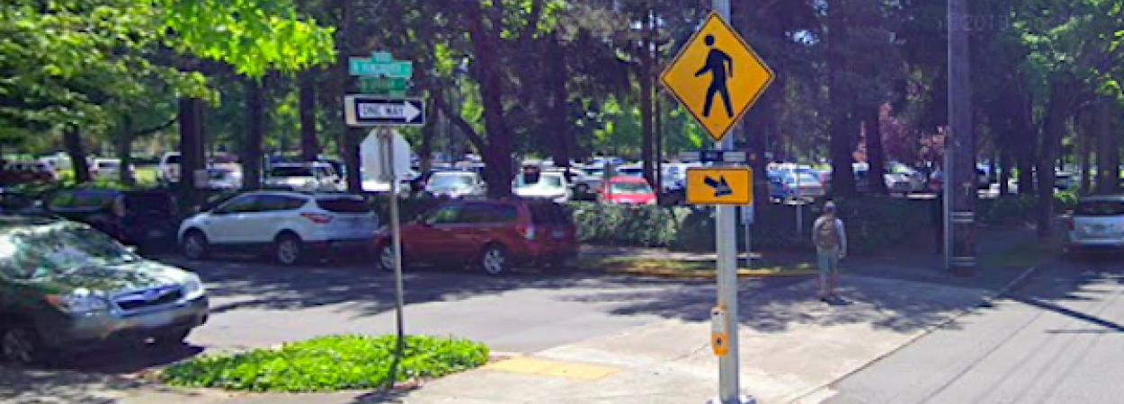
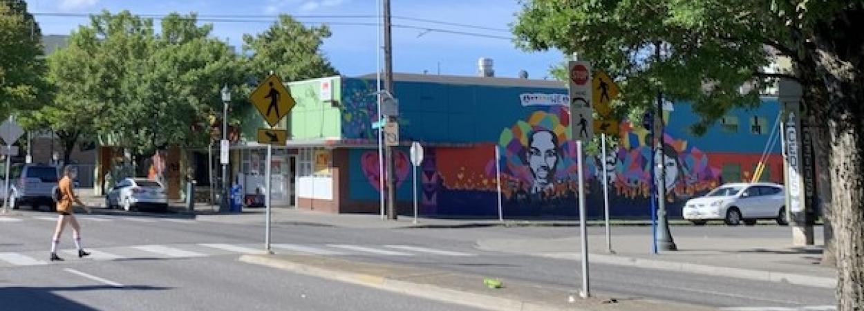
MLK Boulevard in Portland, OR. Photo by Cait McCusker

Suburban Black Poverty in East Portland: The Role of Transportation in Making Ends Meet

Steven Howland, Portland State University

The historically Black district of Albina in Portland, Oregon, due to racist real estate practices, faced multiple displacement events between 1960 and 1990 with the construction of Interstate 5 through the heart of the neighborhood as well as wholesale destruction of hundreds of homes to make room for the Memorial Coliseum and various other urban renewal projects. Gentrification in Portland saw a mass displacement of Black households from Albina, largely to East Portland, a suburban area that was unincorporated county land prior to the 1990’s. As Black people were priced out of the Albina neighborhood, businesses and churches have also closed as a result of losing community members.

Supported by a fellowship from the National Institute for Transportation and Communities (NITC), Steven Howland of Portland State University focused his doctoral research on examining the impacts of gentrification on transportation and social support for black working-poor families in Portland, both those who were displaced to East Portland and those who were able to remain in Albina. Through 27 in-depth interviews with parents of young children (13 Albina residents and 14 residents of East Portland), he sought to understand how they used transportation to make ends meet and how those strategies differ between inner-city and suburban neighborhoods.

WHY DO QUALITATIVE RESEARCH?

Qualitative research plays an important role in equitable transportation policy. How does transportation directly affect people’s daily lives and decision-making?  Quantitative data are often used to make policy decisions, yet numbers only tell part of the story. Researchers can gain different knowledge from an in-depth interview than they might learn from a regional survey.

Jennifer Dill, professor in the Nohad A. Toulan School of Urban Studies and Planning and Howland's advisor, points out that qualitative research has the power to shine light on issues that transportation professionals may have not focused on enough.

"When you're trying to make change, it's always great to have a mix of the quantitative and qualitative. It's people's stories that help us understand and change minds," Dill said.

ALBINA: THE EROSION OF A PORTLAND COMMUNITY

"Ferrell’s. Right here it was on Broadway. An ice cream shop. Pietro’s was right next to that. There was like, you know, a couple black-owned businesses that’s gone now. All of them basically are gone now."

"I would go see family more often if I had the gas money to get all the way over like that. But I don’t be having the gas like that to get all the way over there."

"My son lives all the way out east Portland. So, I’m not going to drive out there. And I have two grandsons that live out that way too."

Overall, the cultural rootedness of Albina appeared to be eroding as more and more Black people and businesses left and were being replaced by high-end shops, restaurants, and white people.

Despite the significant cultural losses, the residents of Albina had easier transportation (including a higher rate of car ownership), better-resourced and easily accessed social support networks, and a higher density of nearby destinations to get around easier and accomplish more in a day. East Portlanders struggled far more. 

"It really felt like the people in Albina, even for those that were still paying market rent, they still seemed on average to be doing slightly better than those living in East Portland. Even with the higher rents they still had a lot of resources nearby that they could tap into," Howland said.

EAST PORTLAND: A NEIGHBORHOOD OUT OF REACH

"It's either food or gas, a lot of the time."

"Trying to find shortcuts. Go straight there. I just do my triangle: work, home and school."

East Portland residents had to go the furthest for all their activities. Clustering of destinations around the western edge of East Portland put groceries, school and other activities out of reach for most residents. The longer distances between destinations meant more time traveling. That extra time meant they could not get as much done in a day as those living in Albina. Support networks for people in East Portland featured a lot of friends and family that had also been displaced, but everything was so spread out that they were more socially isolated. They often had to turn to their network living in Albina for their more critical needs like childcare, but it took a lot more effort to utilize.

GETTING AROUND: RELIABILITY OF DRIVING VS SAFETY CONCERNS ON TRANSIT

"The buses don’t come when they say they’re going to come. You have to wait for the bus, and they aren’t going to stop. If you’re having to be at a place at a certain time you can’t depend on the bus to get you there on time."

"There was certain jobs that weren’t along a transit line. Maybe a mile or two miles off the line. I didn’t have a car to get there so I couldn’t take the job."

Howland interviewed participants on how they made choices on getting around, the effects those choices had on their lives, and how they adapted to maintain their mobility. Data doesn’t tell the whole story. The narrative behind the mobility experiences of low-income Black community members often gets washed out or misrepresented in the existing data. By understanding their lived experiences and challenges, policy makers and planners are better equipped to intervene.

Overall, the interviews revealed that Albina residents were more likely to drive than East Portlanders. Both populations shared a preference for driving over transit. East Portland in particular is transit-poor, so the lack of ability to get around without a car has upended many aspects of families' lives. 

"Last time we rode public transportation there’s this dude on there and he was just crazy. Tweaking out really bad. And he kept looking at my son and I’m like, you say something to him I’m going to jail today."

"My 18-year-old, he rode it all the time…But it’s a point where I pulled up a time I was driving home and I seen this fight going on, on the platform of the TriMet [MAX stop]. This grown man fighting kids. I pulled up and it was my son [one of the kids]. Some Caucasian guy fighting some black kids and the black kids get in trouble."

Distance and time were factors, of course, that led participants to prefer getting around by driving rather than using transit. Another finding, which Howland had not anticipated, was that safety concerns were also a major deterrent to riding transit.

This was spurred in part by the 2017 racially-motivated murders on the MAX train, which happened the same summer that Howland was conducting interviews. More often however, the concerns had to do with participants' encounters with people experiencing houselessness as well as people with untreated mental illnesses and addictions, which often spilled over into racists outbursts or threats of violence against them or their children.

Highlights from the Findings:

  • Albina Residents (62%) were more likely to drive than East Portlanders (36%)

  • Nearly universal dislike of TriMet, and nearly everyone had safety concerns taking transit. No drivers expressed safety issues driving. 

  • Drivers were more likely to use transit as an alternative, and transit riders were more likely to turn to getting rides as an alternative.

  • Albina residents struggled less in their daily life maintenance, giving them more means to own a car. 

  • East Portland residents gained marginally more benefit from car ownership, but struggled more to own. East Portland residents also had more difficulty getting rides. 

  • Albina residents had positive associations with walking, whereas East Portland residents would walk, but with higher cost due to distances and multiple safety issues. 

  • Very few people rode a bike, but it was more common for their kids - mostly limited to Albina. 

TAKEAWAYS FOR TRANSPORTATION PROFESSIONALS

Marginalized individuals have said that they feel more vulnerable to harassment when biking or riding transit, and research has shown there is racism even at the crosswalk - so it feels like the safest place is in a car. If encouraging car-free travel is a priority, planners, engineers and policymakers need to come up with solutions to make transit, biking, walking and rolling feel safer for the most marginalized.

While East Portland has had a lot of investments in road safety, it is the distance between destinations that has really hurt people's ability to survive. As East Portland continues to grow with more low-income people of color, more attention needs to go to the urban development of the area to make daily life easier.

"We have to recognize how our plans impact people. It's not just the space, not just the environment; it's the people themselves. They are impacted. We need to recognize that what we think should be done will have consequences, and we need to be able to plan for those consequences," Howland said.

Implementing anti-displacement housing policies to prevent the dissolution of a community is key, but with that is also being proactively aware of where people might end up if they do get displaced from a newly gentrified area. Community ties are vital for quality of life, particularly as people get older and the design concepts behind aging in place become more critical to apply to transportation projects.

"It's nuanced, but recognize that if you can start to identify an area where a lot of people are being displaced to, you need to start implementing plans there as soon as possible," Howland said.

Howland graduated from Portland State with his PhD in Spring 2020. This summer he received a job offer from the Federal Reserve Bank of Kansas City to be an Assistant Economist. He will be working in their Community Development section doing research informed by community stakeholders.

This research was funded by the National Institute for Transportation and Communities.

RELATED RESEARCH

To learn more about this and other TREC research, sign up for our monthly research newsletter.

The National Institute for Transportation and Communities (NITC) is one of seven U.S. Department of Transportation national university transportation centers. NITC is a program of the Transportation Research and Education Center (TREC) at Portland State University. This PSU-led research partnership also includes the Oregon Institute of Technology, University of Arizona, University of Oregon, University of Texas at Arlington and University of Utah. We pursue our theme — improving mobility of people and goods to build strong communities — through research, education and technology transfer.

Projects
1079
Researchers
showland@pdx.edu

Tags